Area Overview for DN15 9RW
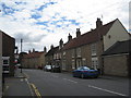
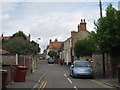
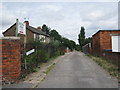
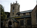
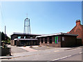
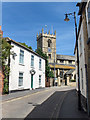
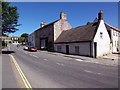
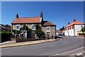
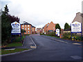
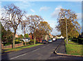
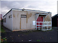
Photos of DN15 9RW

Area Information
DN15 9RW is a small, compact postcode area in England, home to 1,695 residents spread across 181 people per square kilometre. This residential cluster is characterised by its modest size and proximity to nearby towns, making it a practical choice for those seeking a quiet, community-oriented lifestyle. The area’s population is predominantly adults aged 30–64, with a median age of 47, suggesting a stable, mature demographic. Most residents own their homes, with 84% of properties in private ownership, and housing is largely composed of traditional family homes. Daily life in DN15 9RW balances local amenities with easy access to transport links, including three rail stations and a nearby airport. While the area lacks large-scale developments, its small size fosters a close-knit feel, with residents often knowing their neighbours. For those prioritising security and convenience, DN15 9RW offers a blend of practicality and simplicity, though its limited size means the local landscape is best suited for those content with a modest, uncluttered environment.
- Area Type
- Postcode
- Area Size
- Not available
- Population
- 1695
- Population Density
- 181 people/km²
The property market in DN15 9RW is dominated by owner-occupied homes, with 84% of properties in private hands. This suggests a community of long-term residents rather than a transient rental market. The accommodation type is exclusively houses, which is unusual for areas with higher density housing. This configuration may appeal to buyers seeking family homes with more space, though the small size of DN15 9RW means the available housing stock is limited. The high home ownership rate indicates strong local attachment, which can stabilise property values but may also reduce availability for new buyers. Those considering the area should note that the market is not geared towards investment or short-term lets. Proximity to nearby towns and transport links, including rail and airport access, could enhance the area’s appeal, though the immediate surroundings offer few alternative housing options.
House Prices in DN15 9RW
No properties found in this postcode.
Energy Efficiency in DN15 9RW
The lifestyle in DN15 9RW is shaped by its proximity to essential amenities within practical reach. Retail options include Tesco Winterton, Co-op Winterton, and Spar, providing everyday shopping needs. The area’s small size ensures these venues are accessible without long commutes. For travel, three rail stations—Brough, Scunthorpe, and North Ferriby—offer connections to wider networks, while Brough Airport is a short distance away, adding to the area’s transport versatility. The lack of large-scale leisure or recreational facilities means residents may need to venture to nearby towns for activities like dining out or cultural events. However, the presence of local shops and transport links ensures daily life remains convenient, with a focus on practicality over luxury.
Amenities
Schools
The nearest school to DN15 9RW is Flourish With Us, a special school catering to students with specific educational needs. This is the only school listed in the area, meaning families must look beyond DN15 9RW for mainstream education options. The presence of a special school highlights the area’s focus on supporting niche educational requirements, though it does not provide a comprehensive range of school types for all age groups. Parents seeking a broader selection of schools, including primary or secondary institutions, will need to consider nearby towns or commute. The single school in the area underscores the importance of researching additional educational facilities outside DN15 9RW to meet the needs of growing families.
| Rank | School | Type | Entry gender | Ages |
|---|
Explore more schools in this area
Go to Schools tabDemographics
The community in DN15 9RW is largely composed of adults aged 30–64, with a median age of 47. This suggests a population that is primarily in their prime working years, with a strong presence of middle-aged families. Home ownership is high, at 84%, indicating a preference for long-term residency over rental properties. The accommodation type is predominantly houses, which aligns with the area’s small, residential character. The predominant ethnic group is White, reflecting a homogenous demographic profile. While no specific data on deprivation is provided, the high home ownership rate and stable age distribution suggest a relatively stable quality of life. The absence of significant demographic diversity may appeal to those seeking a familiar, consistent community structure, though it also means the area’s cultural and social dynamics are relatively uniform.
Household Size
Accommodation Type
Tenure
Ethnic Group
Religion
Household Composition
Age
Household Deprivation
NS-SEC
Explore more demographic insights in this area
Go to Demographics tabPlanning
Planning Constraints
- Flood RiskPremium
- Ramsar Wetland SitesPremium
- Area of Outstanding Natural BeautyPremium
- Protected Nature ReservePremium
- Protected WoodlandPremium