Area Overview for DN15 9QW
Photos of DN15 9QW
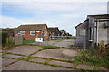
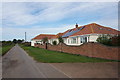
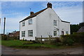
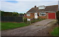
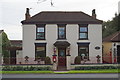
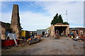
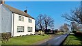
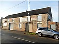
24 photos from this area
Area Information
Key information about the DN15 9QW including its size, population, and administrative classification.
- Area Type
- Postcode
- Area Size
- 16.4 hectares
- Population
- 1500
- Population Density
- 549 people/km²
House Prices in DN15 9QW
15
Properties
£207,500
Average Sold Price
£130,000
Lowest Price
£360,000
Highest Price
Showing 15 properties
| Address | Type | Beds | Baths | Last Sale Price | Last Sale Date | |
|---|---|---|---|---|---|---|
| 87 North Street, Winterton, DN15 9QW | Semi-detached | 2 | 1 | £180,000 | Aug 2024 | |
| 99 North Street, Winterton, DN15 9QW | house | 3 | - | £360,000 | May 2022 | |
| 51 North Street, Winterton, DN15 9QW | Detached | 3 | 1 | £175,000 | Jun 2020 | |
| 97 North Street, Winterton, DN15 9QW | house | - | - | £220,000 | Aug 2018 | |
| 97A North Street, Winterton, DN15 9QW | Bungalow | - | - | £180,000 | May 2013 | |
| 89 North Street, Winterton, DN15 9QW | Semi-detached | 3 | 1 | £130,000 | Nov 2010 | |
| 125 North Street, Winterton, DN15 9QW | Semi-detached | - | - | - | - | |
| Workshop, 91-93 North Street, Winterton, DN15 9QW | Industrial | - | - | - | - | |
| 55 North Street, Winterton, DN15 9QW | Detached | - | - | - | - | |
| 127 North Street, Winterton, DN15 9QW | Flat | - | - | - | - |
Page 1 of 2
Energy Efficiency in DN15 9QW
Amenities
Schools
| Rank | School | Type | Entry gender | Ages |
|---|
Explore more schools in this area
Go to Schools tabDemographics
Household Size
Two person
most common
Accommodation Type
Houses
most common
Tenure
82
majority
Ethnic Group
White
most common
Religion
N/A
most common
Household Composition
N/A
most common
Age
47
median
Adults (30-64 years)
most common
Household Deprivation
N/A
with no deprivation
NS-SEC
29
in Lower managerial occupations
Explore more demographic insights in this area
Go to Demographics tabPlanning
Planning Constraints
- Flood RiskPremium
- Ramsar Wetland SitesPremium
- Area of Outstanding Natural BeautyPremium
- Protected Nature ReservePremium
- Protected WoodlandPremium