Area Overview for DN15 8QL
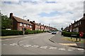
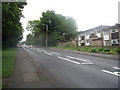
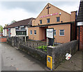
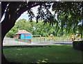
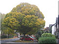
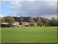
Photos of DN15 8QL


Area Information
Living in DN15 8QL means inhabiting a small, defined residential cluster in England, home to 1,842 people. This area is characterised by its compact size and proximity to essential services, making it a practical choice for those seeking a balance between privacy and accessibility. The community is predominantly composed of adults aged 30–64, reflecting a mature demographic with established routines. While the area lacks large-scale infrastructure, its compact nature ensures that daily needs are within reach. Residents benefit from nearby retail options and rail connections, which link them to broader regional networks. The absence of significant environmental constraints, such as protected woodlands or areas of outstanding natural beauty, means development is unencumbered, though this also means the landscape is not defined by natural landmarks. For buyers, DN15 8QL offers a straightforward, no-frills living environment, ideal for those prioritising practicality over scenic vistas. Its small size means the character of the area is uniform, with homes predominantly in the private ownership sector.
- Area Type
- Postcode
- Area Size
- Not available
- Population
- 1842
- Population Density
- 10360 people/km²
The property market in DN15 8QL is shaped by its low home ownership rate of 28%, indicating that the area is not primarily owner-occupied. Instead, it functions more as a rental market, with houses forming the majority of the housing stock. This suggests a limited supply of private residences, which could make buying a home challenging for those seeking long-term investment. The small size of the area means property choices are constrained, with fewer options available compared to larger towns or cities. For buyers, this could translate to competition for the limited number of owner-occupied homes, particularly if the area is perceived as a practical, no-frills location. The predominance of houses over flats or apartments also means that property values may be influenced by factors such as land size and garden space, which are less relevant in urban settings. Prospective buyers should consider the area’s compact nature and the potential for limited future development when evaluating its appeal.
House Prices in DN15 8QL
No properties found in this postcode.
Energy Efficiency in DN15 8QL
Daily life in DN15 8QL is supported by a modest but functional array of amenities. Retail options include Sainsburys Scunthorpe, Lidl Central, and Farmfoods Scunthorpe, providing essential shopping and grocery needs within practical reach. These stores cater to both everyday purchases and larger weekly shopping trips, reducing the need for long commutes. The area’s rail network, with stations at Scunthorpe and Althorpe, connects residents to broader regional services, enabling access to cultural, leisure, and professional opportunities beyond the immediate postcode. While the data does not mention parks or recreational spaces, the presence of retail and transport infrastructure suggests a focus on practicality over leisure. For residents prioritising convenience and connectivity, DN15 8QL offers a straightforward lifestyle with minimal need for extensive travel, though those seeking natural or cultural amenities may need to venture further afield.
Amenities
Schools
The nearest school to DN15 8QL is Lynton Preparatory School, an independent institution. This type of school typically caters to younger students and operates on a fee-paying basis, which may influence its accessibility for families. The absence of state-funded schools in the immediate vicinity means that families relying on free education may need to look beyond the area for options. Independent schools like Lynton often provide specialist facilities and smaller class sizes, which can be advantageous for those prioritising tailored education. However, the lack of nearby state schools could pose logistical challenges, particularly for parents without private education budgets. For families considering DN15 8QL, the presence of an independent school adds a layer of exclusivity but also necessitates a strategic approach to broader educational planning.
| Rank | School | Type | Entry gender | Ages |
|---|
Explore more schools in this area
Go to Schools tabDemographics
The population of DN15 8QL is 1,842, with a median age of 47, indicating a community skewed towards middle-aged adults. The most common age range is 30–64, suggesting a stable, working-age population with limited presence of younger or older residents. Home ownership in the area is low, at 28%, implying that the majority of households are renters. This statistic aligns with the accommodation type data, which shows that houses are the predominant housing stock. The demographic is overwhelmingly White, with no specific data on other ethnic groups provided. The low home ownership rate may reflect economic pressures or a transient population. For quality of life, this suggests a community where long-term stability is less common, and rental costs could be a significant factor. The absence of detailed data on deprivation or income levels means broader socioeconomic context remains unclear, but the figures highlight a mature, possibly professional demographic with limited family-oriented housing options.
Household Size
Accommodation Type
Tenure
Ethnic Group
Religion
Household Composition
Age
Household Deprivation
NS-SEC
Explore more demographic insights in this area
Go to Demographics tabPlanning
Planning Constraints
- Flood RiskPremium
- Ramsar Wetland SitesPremium
- Area of Outstanding Natural BeautyPremium
- Protected Nature ReservePremium
- Protected WoodlandPremium