Area Overview for DN15 7HN
Photos of DN15 7HN

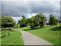
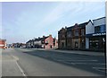
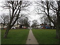
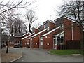
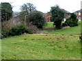
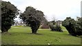
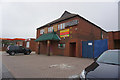
52 photos from this area
Area Information
Key information about the DN15 7HN including its size, population, and administrative classification.
- Area Type
- Postcode
- Area Size
- 1.1 hectares
- Population
- 1652
- Population Density
- 4435 people/km²
House Prices in DN15 7HN
30
Properties
£115,903
Average Sold Price
£38,500
Lowest Price
£200,000
Highest Price
Showing 30 properties
| Address | Type | Beds | Baths | Last Sale Price | Last Sale Date | |
|---|---|---|---|---|---|---|
| 32 Newland Avenue, Scunthorpe, DN15 7HN | Semi-detached | 3 | - | £158,000 | May 2025 | |
| 37 Newland Avenue, Scunthorpe, DN15 7HN | Semi-detached | 3 | - | £185,000 | Jan 2023 | |
| 28 Newland Avenue, Scunthorpe, DN15 7HN | house | - | - | £200,000 | Nov 2021 | |
| 26 Newland Avenue, Scunthorpe, DN15 7HN | Semi-detached | 3 | 1 | £129,000 | Apr 2021 | |
| 19 Newland Avenue, Scunthorpe, DN15 7HN | Semi-detached | 3 | 1 | £117,500 | Jul 2019 | |
| 43A Newland Avenue, Scunthorpe, DN15 7HN | Detached | 3 | 1 | £150,000 | May 2019 | |
| 47 Newland Avenue, Scunthorpe, DN15 7HN | house | 3 | 1 | £103,000 | Oct 2017 | |
| 21 Newland Avenue, Scunthorpe, DN15 7HN | Semi-detached | 3 | 1 | £120,000 | Oct 2016 | |
| 30 Newland Avenue, Scunthorpe, DN15 7HN | Semi-detached | 3 | 1 | £107,500 | May 2016 | |
| 29 Newland Avenue, Scunthorpe, DN15 7HN | Semi-detached | 3 | 1 | £112,000 | Dec 2015 |
Page 1 of 3
Energy Efficiency in DN15 7HN
Amenities
Schools
| Rank | School | Type | Entry gender | Ages |
|---|
Explore more schools in this area
Go to Schools tabDemographics
Household Size
Family (3-5 people)
most common
Accommodation Type
Houses
most common
Tenure
67
majority
Ethnic Group
White
most common
Religion
N/A
most common
Household Composition
N/A
most common
Age
47
median
Adults (30-64 years)
most common
Household Deprivation
N/A
with no deprivation
NS-SEC
27
in Lower managerial occupations
Explore more demographic insights in this area
Go to Demographics tabPlanning
Planning Constraints
- Flood RiskPremium
- Ramsar Wetland SitesPremium
- Area of Outstanding Natural BeautyPremium
- Protected Nature ReservePremium
- Protected WoodlandPremium