Area Overview for DN15 7DH
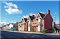
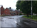
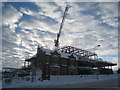
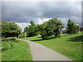
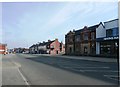
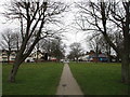
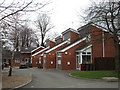
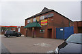
Photos of DN15 7DH


Area Information
DN15 7DH is a small, tightly knit residential postcode area in England with a population of 1,613. It is characterised by a cluster of homes, predominantly houses, which cater to a mature demographic. The median age of 47 suggests a community of established residents, many of whom are in the 30-64 age bracket. This area is not densely populated, offering a quiet, low-rise living environment. Residents benefit from proximity to essential services, including retail outlets like Morrisons Daily and Sainsburys Scunthorpe, as well as three nearby railway stations—Scunthorpe, Althorpe, and Crowle—which provide easy access to regional transport networks. The area is also served by a mix of primary and secondary education options, including High Ridge School and The St Lawrence Academy. While the population is relatively small, the combination of stable housing, accessible transport, and local amenities makes DN15 7DH a practical choice for those seeking a balanced, community-focused lifestyle.
- Area Type
- Postcode
- Area Size
- Not available
- Population
- 1613
- Population Density
- 3540 people/km²
DN15 7DH is primarily an owner-occupied area, with 74% of residents living in homes they own. The accommodation type is predominantly houses, which suggests a focus on family homes and larger properties rather than apartments or flats. This composition indicates a market where property values are likely to be stable, given the lower turnover typical of owner-occupied areas. The small size of the postcode area means the housing stock is limited, but the high home ownership rate suggests a strong sense of local attachment. For buyers, this implies a potential for long-term investment but also a need to consider the limited availability of new properties. The presence of houses rather than rental units may also mean fewer short-term letting options, appealing to those prioritising permanence over flexibility.
House Prices in DN15 7DH
No properties found in this postcode.
Energy Efficiency in DN15 7DH
Residents of DN15 7DH have access to a range of nearby amenities that support daily life. The area is served by five retail outlets, including major supermarkets such as Morrisons Daily, Sainsburys Scunthorpe, and Asda Parkside, ensuring convenience for shopping and household needs. The three railway stations—Scunthorpe, Althorpe, and Crowle—provide easy access to broader transport networks, enhancing connectivity for both work and leisure. While the data does not specify parks or leisure facilities, the presence of retail and transport options suggests a practical, community-focused lifestyle. The combination of local shops and efficient rail links means residents can manage errands and travel with minimal reliance on a car, contributing to a balanced and accessible way of life.
Amenities
Schools
Residents of DN15 7DH have access to two schools within practical reach. High Ridge School is a primary school, offering education for younger children, while The St Lawrence Academy is an academy with an Ofsted rating of satisfactory. The combination of a primary school and an academy provides families with options for both early and secondary education. The St Lawrence Academy’s satisfactory rating indicates it meets basic standards but may not excel in specialist areas. For parents, this mix of school types can be advantageous, allowing them to choose between a traditional primary school and a more structured academy environment. The proximity of these schools to the area underscores the importance of education in the local community.
| Rank | School | Type | Entry gender | Ages |
|---|
Explore more schools in this area
Go to Schools tabDemographics
The population of DN15 7DH is 1,613, with a median age of 47, indicating a mature community. The most common age range is adults aged 30-64, suggesting a mix of working professionals and families. Home ownership is high at 74%, reflecting a predominantly owner-occupied area with a focus on houses rather than flats. The predominant ethnic group is White, and the data does not indicate significant diversity beyond this. The age profile implies a stable, low-turnover population, which can contribute to a cohesive local identity. With no specific data on deprivation, it is reasonable to infer that the area’s services and amenities are sufficient for its size. The absence of significant demographic diversity may appeal to those seeking a familiar, homogeneous community.
Household Size
Accommodation Type
Tenure
Ethnic Group
Religion
Household Composition
Age
Household Deprivation
NS-SEC
Explore more demographic insights in this area
Go to Demographics tabPlanning
Planning Constraints
- Flood RiskPremium
- Ramsar Wetland SitesPremium
- Area of Outstanding Natural BeautyPremium
- Protected Nature ReservePremium
- Protected WoodlandPremium