Area Overview for DN15 7DF
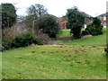
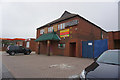
Photos of DN15 7DF


Area Information
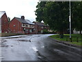
Living in DN15 7DF means inhabiting a compact residential cluster in England, where 1,780 people reside across just 1.3 hectares. The area’s high population density of 133,216 people per square kilometre reflects its small, tightly knit character. This postcode is defined by its proximity to key local amenities and schools, making it a practical choice for families and professionals. The community is predominantly composed of adults aged 30–64, with a median age of 47, suggesting a mature demographic focused on stability. While the area lacks expansive green spaces or natural features, its strategic location near retail hubs and rail links offers convenience. Residents benefit from excellent broadband connectivity, with a score of 99, ensuring seamless digital access. However, the area’s compact size means it is best suited for those prioritising proximity to services over sprawling landscapes. DN15 7DF is not for those seeking isolation; it is a place where daily life revolves around local shops, schools, and transport networks, with a clear emphasis on practicality over grandeur.
- Area Type
- Postcode
- Area Size
- 1.3 hectares
- Population
- 1780
- Population Density
- 6094 people/km²
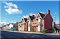
DN15 7DF’s property market is shaped by its 39% home ownership rate, which points to a rental-dominated landscape. The area’s housing stock consists primarily of houses, a rarity in many modern developments, which may appeal to buyers seeking traditional family homes. However, the small area size of 1.3 hectares suggests limited housing stock, potentially restricting availability. For buyers, this means competition for properties, particularly given the area’s proximity to schools and amenities. The low home ownership rate also indicates that many residents are renters, which could influence property values and demand. Investors should consider the local rental market’s strength, though the compact size of DN15 7DF may limit scalability. Buyers looking for a home here should prioritise proximity to nearby schools, retail, and rail links, as these are the area’s key selling points. The absence of flats or apartments further narrows the market to those seeking single-family homes.
House Prices in DN15 7DF
Showing 2 properties
| Address | Type | Beds | Baths | Last Sale Price | Last Sale Date | |
|---|---|---|---|---|---|---|
| Adult Education Centre, Doncaster Road, Scunthorpe, DN15 7DF | commercial | - | - | - | - | |
| Sports Hall Adjacent St Lawrence Academy, Doncaster Road, Scunthorpe, DN15 7DF | Leisure | - | - | - | - |
Energy Efficiency in DN15 7DF
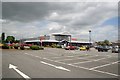
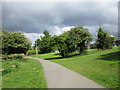
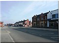
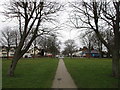
Daily life in DN15 7DF is centred around its retail and transport hubs. Nearby, Morrisons Daily, Sainsburys Scunthorpe, and Lidl Central provide essential shopping, ensuring residents have access to groceries, household items, and daily necessities without long trips. The two railway stations—Scunthorpe and Althorpe—offer connections to broader networks, making it easier to reach workplaces, leisure spots, or family in other regions. While the area lacks parks or green spaces, its compact design prioritises convenience over open land. The presence of schools and retail outlets fosters a community feel, with local amenities serving as focal points for social interaction. For those who value proximity to services, DN15 7DF’s lifestyle is practical, though it may not appeal to those seeking expansive natural environments. The character of the area is defined by its efficiency, with every amenity within a short distance of homes.
Amenities
Schools
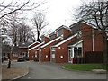
Residents of DN15 7DF have access to three educational institutions within practical reach. Henderson Avenue Primary School offers early years and primary education, while Oasis Academy Henderson Avenue, an academy with an Ofsted rating of ‘good’, provides secondary-level schooling. The Young People’s Education Centre serves as a supplementary facility, likely offering vocational or adult education. This mix of school types ensures families can access both primary and secondary education without long commutes. The presence of an academy with a ‘good’ rating suggests a commitment to quality teaching, though the absence of independent or grammar schools may limit options for parents seeking selective education. For families prioritising school quality, the proximity of these institutions is a key advantage. However, the lack of higher education or specialist facilities means students may need to travel further for advanced studies.
| Rank | School | Type | Entry gender | Ages |
|---|
Explore more schools in this area
Go to Schools tabDemographics
The population of DN15 7DF is predominantly adults aged 30–64, with a median age of 47. This suggests a community focused on established careers and family life, rather than younger or retired residents. Home ownership stands at 39%, which is notably lower than the national average, indicating a significant rental market. The area is characterised by houses as the primary accommodation type, reflecting a preference for traditional family homes over flats. The predominant ethnic group is White, with no data provided on other demographics. The high population density of 133,216 people per square kilometre raises questions about living space per household, though this is typical for small, urbanised postcode areas. For buyers, this demographic profile implies a market skewed towards renters, with limited opportunities for long-term property investment. The absence of detailed deprivation data means it is unclear how economic pressures might affect quality of life, but the age profile suggests a stable, mature community.
Household Size
Accommodation Type
Tenure
Ethnic Group
Religion
Household Composition
Age
Household Deprivation
NS-SEC
Explore more demographic insights in this area
Go to Demographics tabPlanning
Planning Constraints
- Flood RiskPremium
- Ramsar Wetland SitesPremium
- Area of Outstanding Natural BeautyPremium
- Protected Nature ReservePremium
- Protected WoodlandPremium