Area Overview for DN15 7AE
Photos of DN15 7AE

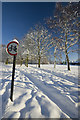
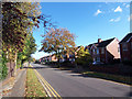
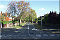
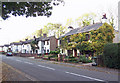
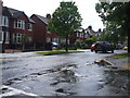
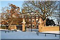
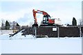
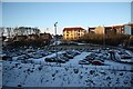
46 photos from this area
Area Information
Key information about the DN15 7AE including its size, population, and administrative classification.
- Area Type
- Postcode
- Area Size
- 2.4 hectares
- Population
- 1896
- Population Density
- 3847 people/km²
House Prices in DN15 7AE
39
Properties
£119,347
Average Sold Price
£32,000
Lowest Price
£390,000
Highest Price
Showing 39 properties
| Address | Type | Beds | Baths | Last Sale Price | Last Sale Date | |
|---|---|---|---|---|---|---|
| 12 Church Lane, Scunthorpe, DN15 7AE | Bungalow | 3 | 1 | £150,000 | Sep 2025 | |
| 33 Church Lane, Scunthorpe, DN15 7AE | Semi-detached | - | - | £60,000 | Sep 2022 | |
| 53 Church Lane, Scunthorpe, DN15 7AE | house | 3 | - | £200,000 | Jul 2022 | |
| 42 Church Lane, Scunthorpe, DN15 7AE | house | 3 | 1 | £149,950 | Apr 2022 | |
| 48 Church Lane, Scunthorpe, DN15 7AE | Retail | 3 | 1 | £135,000 | Apr 2022 | |
| 26 Church Lane, Scunthorpe, DN15 7AE | Retail | 3 | 1 | £390,000 | Feb 2022 | |
| 57 Church Lane, Scunthorpe, DN15 7AE | house | - | - | £180,000 | Oct 2021 | |
| 2 Church Lane, Scunthorpe, DN15 7AE | Detached | 3 | 1 | £245,000 | Jul 2021 | |
| 58 Church Lane, Scunthorpe, DN15 7AE | house | - | - | £125,000 | Mar 2021 | |
| 29 Church Lane, Scunthorpe, DN15 7AE | house | - | - | £130,000 | Nov 2020 |
Page 1 of 4
Energy Efficiency in DN15 7AE
Amenities
Schools
| Rank | School | Type | Entry gender | Ages |
|---|
Explore more schools in this area
Go to Schools tabDemographics
Household Size
One person
most common
Accommodation Type
Houses
most common
Tenure
26
majority
Ethnic Group
White
most common
Religion
N/A
most common
Household Composition
N/A
most common
Age
47
median
Adults (30-64 years)
most common
Household Deprivation
N/A
with no deprivation
NS-SEC
15
in Lower managerial occupations
Explore more demographic insights in this area
Go to Demographics tabPlanning
Planning Constraints
- Flood RiskPremium
- Ramsar Wetland SitesPremium
- Area of Outstanding Natural BeautyPremium
- Protected Nature ReservePremium
- Protected WoodlandPremium