Area Overview for DN15 6RN
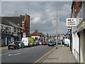
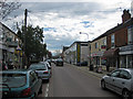
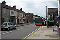
Photos of DN15 6RN
Area Information
Living in DN15 6RN means residing in a small residential cluster within the Metropolitan Borough of Doncaster. This specific postcode covers an area of 1,943 square metres and serves a population of 1,585 people. The density here stands at 472 people per square kilometre, creating a relatively contained environment. Although the area research references wider town wards with coordinates near the centre of Doncaster, this specific postcode remains a distinct pocket within the South Yorkshire region. You are situated in England, part of the Yorkshire and the Humber region. Daily life here revolves around a compact community where neighbours are likely to know one another. The space is defined more by its postcode identity than by expansive green zones or major landmarks visible within the statistical boundary. For prospective buyers, this represents a specific slice of Doncaster rather than a standalone municipality with its own council administration. The area feels integrated into the broader urban fabric while maintaining its own statistical footprint. Understanding this scale is essential for anyone considering homes in this postcode.
- Area Type
- Postcode
- Area Size
- 1943 m²
- Population
- 1585
- Population Density
- 472 people/km²
The property market in DN15 6RN is defined by a high concentration of rental properties and a specific housing type. With home ownership standing at just 28 per cent, the vast majority of homes in this postcode are rented. You are primarily navigating a letting market rather than a buying market for freehold property. The accommodation type data confirms that flats dominate the stock. This means you will encounter little in the way of detached houses, semis, or bungalows outside this specific area. Buyers looking at homes in DN15 6RN should expect to view leasehold properties designed for apartment living. The low ownership rate suggests a reliance on landlords or housing associations. If you are considering this small residential cluster, your search will focus on tenancies or specific purchase opportunities for flats. The lack of significant owner-occupier presence means the market does not behave like a typical suburban estate. Understanding this dynamic is crucial for assessing long-term security and investment potential.
House Prices in DN15 6RN
Showing 13 properties
| Address | Type | Beds | Baths | Last Sale Price | Last Sale Date | |
|---|---|---|---|---|---|---|
| 5 Greens Close, Scunthorpe, DN15 6RN | Flat | - | - | - | - | |
| 8 Greens Close, Scunthorpe, DN15 6RN | Flat | - | - | - | - | |
| 10 Greens Close, Scunthorpe, DN15 6RN | Flat | - | - | - | - | |
| 7 Greens Close, Scunthorpe, DN15 6RN | Flat | - | - | - | - | |
| 13 Greens Close, Scunthorpe, DN15 6RN | Flat | - | - | - | - | |
| 9 Greens Close, Scunthorpe, DN15 6RN | Flat | - | - | - | - | |
| 4 Greens Close, Scunthorpe, DN15 6RN | Flat | - | - | - | - | |
| 11 Greens Close, Scunthorpe, DN15 6RN | Flat | - | - | - | - | |
| 2 Greens Close, Scunthorpe, DN15 6RN | Flat | - | - | - | - | |
| 3 Greens Close, Scunthorpe, DN15 6RN | Flat | - | - | - | - |
Energy Efficiency in DN15 6RN
Your lifestyle in DN15 6RN benefits from several retail and transport hubs located nearby. Retail options include Asda Scunthorpe, Heron Scunthorpe, and Iceland Southgate, all listed within practical reach of the postcode. These venues provide essential shopping for groceries and general goods without the need for long drives. For commuting, you have access to two nearby railway stations: Scunthorpe Railway Station and Althorpe Railway Station. This rail link integrates you with the wider network. While the small area size of 1,943 square metres limits local green space, the proximity to larger towns compensates for this. You will find most daily necessities within a short drive or shop visit. The character of the area is urban and functional rather than rural or leisure-focused. Dining and leisure options are likely found in the surrounding towns of Scunthorpe or Southgate. This setup provides convenience for daily errands while requiring travel for entertainment or cultural events.
Amenities
Schools
Families considering schools near DN15 6RN have two main options within practical reach. The area lists Dawes Lane Academy as a nearby educational institution, though its specific type is categorised as other than the standard definitions. For secondary education, residing in this postcode places students close to Engineering UTC Northern Lincolnshire. This secondary school holds a good Ofsted rating, a significant factor for parents evaluating options. The presence of a UTC (University TechnicalCollege) is notable for prospective parents seeking technical education pathways. The mix of school types suggests access to varied educational philosophies. While Dawes Lane Academy offers an alternative provision or different educational model, the Engineering UTC provides a structured secondary pathway with technical focus. You do not have primary or infant school data attached to this specific postcode cluster. Consequently, families may need to look slightly beyond the immediate immediate vicinity for early years education. The availability of a secondary school with a good rating provides a strong educational anchor for the local community.
| Rank | School | Type | Entry gender | Ages |
|---|
Explore more schools in this area
Go to Schools tabDemographics
The community in DN15 6RN presents a distinct demographic profile characterised by an older population. The median age is 47, falling firmly within the adult bracket. Most residents are adults between 30 and 64 years old. You will find few teenagers or young children compared to the number of working-age and retired adults. Home ownership plays a marginal role, with only 28 per cent of households owning their property outright. This indicates that the majority of residents are tenants. The accommodation type is predominantly flats, shaping the internal layout and community interaction. You are looking at a high-street or block-style living situation rather than detached houses. Predominantly, the population identifies as White, reflecting a relatively homogenous ethnic mix. The high proportion of adults living in flats suggests a working population or retirees who do not require large garden spaces. This social structure influences the area's quietness during the day and evening.
Household Size
Accommodation Type
Tenure
Ethnic Group
Religion
Household Composition
Age
Household Deprivation
NS-SEC
Explore more demographic insights in this area
Go to Demographics tabPlanning
Planning Constraints
- Flood RiskPremium
- Ramsar Wetland SitesPremium
- Area of Outstanding Natural BeautyPremium
- Protected Nature ReservePremium
- Protected WoodlandPremium