Area Overview for DN15 6DL
Photos of DN15 6DL
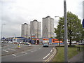
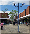
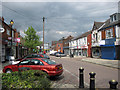
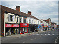
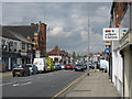
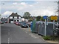
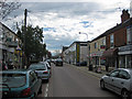
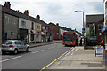
100 photos from this area
Area Information
Key information about the DN15 6DL including its size, population, and administrative classification.
- Area Type
- Postcode
- Area Size
- 3889 m²
- Population
- 1765
- Population Density
- 1943 people/km²
House Prices in DN15 6DL
24
Properties
£53,258
Average Sold Price
£25,000
Lowest Price
£80,000
Highest Price
Showing 24 properties
| Address | Type | Beds | Baths | Last Sale Price | Last Sale Date | |
|---|---|---|---|---|---|---|
| 21 Sheffield Street East, Scunthorpe, DN15 6DL | house | - | - | £80,000 | Oct 2022 | |
| 36 Sheffield Street East, Scunthorpe, DN15 6DL | house | - | - | £50,000 | May 2021 | |
| 29 Sheffield Street East, Scunthorpe, DN15 6DL | Terraced | 2 | - | £55,000 | Mar 2019 | |
| 19 Sheffield Street East, Scunthorpe, DN15 6DL | Terraced | 2 | 2 | £52,500 | Feb 2019 | |
| 34 Sheffield Street East, Scunthorpe, DN15 6DL | Terraced | 2 | 2 | £49,000 | Sep 2018 | |
| 27 Sheffield Street East, Scunthorpe, DN15 6DL | Terraced | 2 | 1 | £44,000 | Jun 2016 | |
| 31A Sheffield Street East, Scunthorpe, DN15 6DL | Flat | - | - | £53,918 | Mar 2016 | |
| 30 Sheffield Street East, Scunthorpe, DN15 6DL | house | - | - | £53,000 | May 2015 | |
| 38 Sheffield Street East, Scunthorpe, DN15 6DL | house | - | - | £73,000 | Jan 2012 | |
| 26 Sheffield Street East, Scunthorpe, DN15 6DL | house | - | - | £62,000 | May 2009 |
Page 1 of 3
Energy Efficiency in DN15 6DL
Amenities
Schools
| Rank | School | Type | Entry gender | Ages |
|---|
Explore more schools in this area
Go to Schools tabDemographics
Household Size
Family (3-5 people)
most common
Accommodation Type
Houses
most common
Tenure
30
majority
Ethnic Group
White
most common
Religion
N/A
most common
Household Composition
N/A
most common
Age
47
median
Adults (30-64 years)
most common
Household Deprivation
N/A
with no deprivation
NS-SEC
10
in Lower managerial occupations
Explore more demographic insights in this area
Go to Demographics tabPlanning
Planning Constraints
- Flood RiskPremium
- Ramsar Wetland SitesPremium
- Area of Outstanding Natural BeautyPremium
- Protected Nature ReservePremium
- Protected WoodlandPremium