Area Overview for DN15 0BE
Photos of DN15 0BE
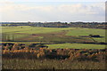
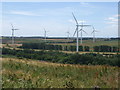
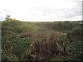
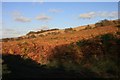
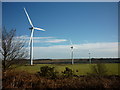
7 photos from this area
Area Information
Key information about the DN15 0BE including its size, population, and administrative classification.
- Area Type
- Postcode
- Area Size
- 1.9 km²
- Population
- 1592
- Population Density
- 117 people/km²
House Prices in DN15 0BE
48
Properties
£99,302
Average Sold Price
£17,500
Lowest Price
£360,000
Highest Price
Showing 48 properties
| Address | Type | Beds | Baths | Last Sale Price | Last Sale Date | |
|---|---|---|---|---|---|---|
| Tudor House, High Street, Dragonby, DN15 0BE | Semi-detached | 3 | 1 | £150,000 | May 2025 | |
| 34 High Street, Dragonby, DN15 0BE | house | 3 | - | £105,000 | May 2025 | |
| 26 High Street, Dragonby, DN15 0BE | Terraced | 2 | 1 | £115,000 | Mar 2025 | |
| 23 High Street, Dragonby, DN15 0BE | Semi-detached | 3 | 1 | £95,000 | Aug 2024 | |
| 16 High Street, Dragonby, DN15 0BE | Semi-detached | 2 | 1 | £112,000 | Jun 2024 | |
| 30 High Street, Dragonby, DN15 0BE | Terraced | 3 | 1 | £97,000 | May 2024 | |
| Seldom Inn, High Street, Dragonby, DN15 0BE | Bungalow | 3 | 3 | £270,000 | Oct 2023 | |
| The Rustlings, High Street, Dragonby, DN15 0BE | Retail | 5 | 2 | £360,000 | Apr 2022 | |
| 21 High Street, Dragonby, DN15 0BE | house | - | - | £145,000 | Sep 2021 | |
| 5 High Street, Dragonby, DN15 0BE | house | - | - | £97,500 | Dec 2020 |
Page 1 of 5
Energy Efficiency in DN15 0BE
Amenities
Schools
| Rank | School | Type | Entry gender | Ages |
|---|
Explore more schools in this area
Go to Schools tabDemographics
Household Size
Two person
most common
Accommodation Type
Houses
most common
Tenure
74
majority
Ethnic Group
White
most common
Religion
N/A
most common
Household Composition
N/A
most common
Age
47
median
Adults (30-64 years)
most common
Household Deprivation
N/A
with no deprivation
NS-SEC
27
in Lower managerial occupations
Explore more demographic insights in this area
Go to Demographics tabPlanning
Planning Constraints
- Flood RiskPremium
- Ramsar Wetland SitesPremium
- Area of Outstanding Natural BeautyPremium
- Protected Nature ReservePremium
- Protected WoodlandPremium