Area Overview for DN14 9NG
Photos of DN14 9NG
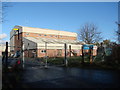
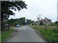
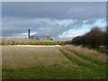
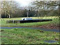
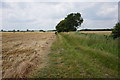
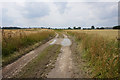
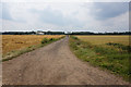
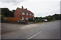
16 photos from this area
Area Information
Key information about the DN14 9NG including its size, population, and administrative classification.
- Area Type
- Postcode
- Area Size
- 5.4 hectares
- Population
- 1045
- Population Density
- 51 people/km²
House Prices in DN14 9NG
29
Properties
£142,279
Average Sold Price
£32,000
Lowest Price
£420,000
Highest Price
Showing 29 properties
| Address | Type | Beds | Baths | Last Sale Price | Last Sale Date | |
|---|---|---|---|---|---|---|
| 4 Mill Lane, Carlton, DN14 9NG | Semi-detached | 3 | 1 | £225,000 | Jun 2025 | |
| 12A Mill Lane, Carlton, DN14 9NG | house | - | - | £198,350 | Nov 2024 | |
| 16 Mill Lane, Carlton, DN14 9NG | Semi-detached | 3 | 1 | £205,000 | Sep 2024 | |
| 23 Mill Lane, Carlton, DN14 9NG | house | - | - | £182,000 | Jun 2024 | |
| 6 Mill Lane, Carlton, DN14 9NG | house | - | - | £129,000 | Jun 2021 | |
| 8 Mill Lane, Carlton, DN14 9NG | house | - | - | £190,000 | Dec 2020 | |
| 12 Mill Lane, Carlton, DN14 9NG | Semi-detached | 3 | 1 | £123,000 | Nov 2018 | |
| The Grange, Mill Lane, Carlton, DN14 9NG | house | 6 | 5 | £420,000 | Aug 2014 | |
| 21 Mill Lane, Carlton, DN14 9NG | house | 2 | 2 | £110,000 | Dec 2013 | |
| 18 Mill Lane, Carlton, DN14 9NG | house | - | - | £65,000 | Jun 2008 |
Page 1 of 3
Energy Efficiency in DN14 9NG
Amenities
Schools
| Rank | School | Type | Entry gender | Ages |
|---|
Explore more schools in this area
Go to Schools tabDemographics
Household Size
Two person
most common
Accommodation Type
Houses
most common
Tenure
82
majority
Ethnic Group
White
most common
Religion
N/A
most common
Household Composition
N/A
most common
Age
47
median
Adults (30-64 years)
most common
Household Deprivation
N/A
with no deprivation
NS-SEC
33
in Lower managerial occupations
Explore more demographic insights in this area
Go to Demographics tabPlanning
Planning Constraints
- Flood RiskPremium
- Ramsar Wetland SitesPremium
- Area of Outstanding Natural BeautyPremium
- Protected Nature ReservePremium
- Protected WoodlandPremium