Area Overview for DN14 9JR
Photos of DN14 9JR
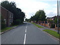
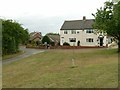
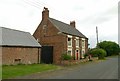
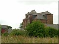
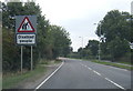
22 photos from this area
Area Information
Key information about the DN14 9JR including its size, population, and administrative classification.
- Area Type
- Postcode
- Area Size
- 1.4 hectares
- Population
- 2066
- Population Density
- 639 people/km²
House Prices in DN14 9JR
8
Properties
£318,333
Average Sold Price
£90,000
Lowest Price
£565,000
Highest Price
Showing 8 properties
| Address | Type | Beds | Baths | Last Sale Price | Last Sale Date | |
|---|---|---|---|---|---|---|
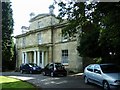
| The Dower House, Pontefract Road, Snaith, DN14 9JR | Retail | 4 | 1 | £300,000 | Mar 2022 | |
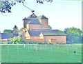
| Snaith Hall, Pontefract Road, Snaith, DN14 9JR | hospital_care_home | - | - | £565,000 | Mar 2019 | |
| Manaura, Pontefract Road, Snaith, DN14 9JR | Detached | - | - | £90,000 | Feb 2002 | |
| Just Peel Group, Hall Lodge, Pontefract Road, Snaith, DN14 9JR | office_workshop | - | - | - | - | |
| Maralda Hall Gardens, Pontefract Road, Snaith, DN14 9JR | Detached | - | - | - | - | |
| The Bungalow, Cadman Lane, Snaith, DN14 9JR | Detached | - | - | - | - | |
| Charlotte Cust Hair, Hall Lodge Annexe, Pontefract Road, Snaith, DN14 9JR | Office | - | - | - | - | |
| Spar, Snaith Hall Filling Station, Pontefract Road, Snaith, DN14 9JR | shop | - | - | - | - |
Energy Efficiency in DN14 9JR
Amenities
Schools
| Rank | School | Type | Entry gender | Ages |
|---|
Explore more schools in this area
Go to Schools tabDemographics
Household Size
Two person
most common
Accommodation Type
Houses
most common
Tenure
82
majority
Ethnic Group
White
most common
Religion
N/A
most common
Household Composition
N/A
most common
Age
47
median
Adults (30-64 years)
most common
Household Deprivation
N/A
with no deprivation
NS-SEC
32
in Lower managerial occupations
Explore more demographic insights in this area
Go to Demographics tabPlanning
Planning Constraints
- Flood RiskPremium
- Ramsar Wetland SitesPremium
- Area of Outstanding Natural BeautyPremium
- Protected Nature ReservePremium
- Protected WoodlandPremium