Area Overview for DN14 9DP
Photos of DN14 9DP
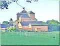
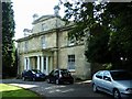
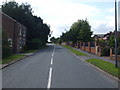
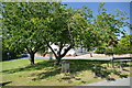
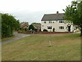
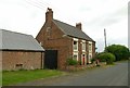
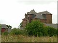
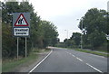
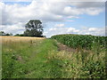
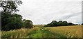
22 photos from this area
Area Information
Key information about the DN14 9DP including its size, population, and administrative classification.
- Area Type
- Postcode
- Area Size
- 1.1 hectares
- Population
- 1801
- Population Density
- 87 people/km²
House Prices in DN14 9DP
18
Properties
£165,531
Average Sold Price
£69,500
Lowest Price
£299,950
Highest Price
Showing 18 properties
| Address | Type | Beds | Baths | Last Sale Price | Last Sale Date | |
|---|---|---|---|---|---|---|
| Pinfold Cottage, 28 Butt Lane, Snaith, DN14 9DP | Bungalow | - | - | £252,500 | May 2024 | |
| 24 Butt Lane, Snaith, DN14 9DP | Detached | 3 | 1 | £175,000 | Oct 2016 | |
| Ramswood, 4 Butt Lane, Snaith, DN14 9DP | house | 4 | - | £165,000 | Apr 2015 | |
| Holmlea, 6 Butt Lane, Snaith, DN14 9DP | Detached | 3 | 3 | £227,000 | Nov 2013 | |
| 18 Butt Lane, Snaith, DN14 9DP | house | - | - | £165,000 | Dec 2012 | |
| 22 Butt Lane, Snaith, DN14 9DP | Bungalow | - | - | £157,000 | Oct 2010 | |
| 10 Butt Lane, Snaith, DN14 9DP | house | 4 | - | £162,000 | Aug 2010 | |
| 30 Butt Lane, Snaith, DN14 9DP | Bungalow | 3 | 2 | £299,950 | Dec 2006 | |
| 12 Butt Lane, Snaith, DN14 9DP | Detached | 4 | 3 | £205,000 | May 2006 | |
| 16 Butt Lane, Snaith, DN14 9DP | Detached | 4 | 3 | £110,000 | Jun 2002 |
Page 1 of 2
Energy Efficiency in DN14 9DP
Amenities
Schools
| Rank | School | Type | Entry gender | Ages |
|---|
Explore more schools in this area
Go to Schools tabDemographics
Household Size
Two person
most common
Accommodation Type
Houses
most common
Tenure
79
majority
Ethnic Group
White
most common
Religion
N/A
most common
Household Composition
N/A
most common
Age
47
median
Adults (30-64 years)
most common
Household Deprivation
N/A
with no deprivation
NS-SEC
36
in Lower managerial occupations
Explore more demographic insights in this area
Go to Demographics tabPlanning
Planning Constraints
- Flood RiskPremium
- Ramsar Wetland SitesPremium
- Area of Outstanding Natural BeautyPremium
- Protected Nature ReservePremium
- Protected WoodlandPremium