Area Overview for DN14 8EY
Photos of DN14 8EY
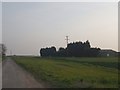
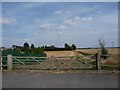
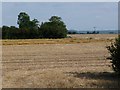
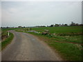
29 photos from this area
Area Information
Key information about the DN14 8EY including its size, population, and administrative classification.
- Area Type
- Postcode
- Area Size
- 10.1 hectares
- Population
- 1517
- Population Density
- 41 people/km²
House Prices in DN14 8EY
12
Properties
£178,833
Average Sold Price
£52,000
Lowest Price
£300,000
Highest Price
Showing 12 properties
| Address | Type | Beds | Baths | Last Sale Price | Last Sale Date | |
|---|---|---|---|---|---|---|
| Thornton House, Main Street, Reedness, DN14 8EY | Bungalow | 4 | - | £280,000 | Nov 2019 | |
| Old Manor House, Main Street, Reedness, DN14 8EY | Detached | 4 | 3 | £300,000 | Aug 2019 | |
| Woodgarth House, Main Street, Reedness, DN14 8EY | Detached | 3 | 1 | £140,000 | Mar 2017 | |
| Hargreaves House, Main Street, Reedness, DN14 8EY | house | - | - | £210,000 | Jan 2012 | |
| North View, Main Street, Reedness, DN14 8EY | Bungalow | 2 | 1 | £91,000 | Jun 2011 | |
| The Foxys, Main Street, Reedness, DN14 8EY | Detached | - | - | £52,000 | Jul 2001 | |
| Rosedene, Main Street, Reedness, DN14 8EY | house | - | - | - | - | |
| Glaydon, Main Street, Reedness, DN14 8EY | Detached | - | - | - | - | |
| Ashires, Main Street, Reedness, DN14 8EY | Detached | - | - | - | - | |
| The Beeches, Main Street, Reedness, DN14 8EY | house | - | - | - | - |
Page 1 of 2
Energy Efficiency in DN14 8EY
Amenities
Schools
| Rank | School | Type | Entry gender | Ages |
|---|
Explore more schools in this area
Go to Schools tabDemographics
Household Size
Two person
most common
Accommodation Type
Houses
most common
Tenure
72
majority
Ethnic Group
White
most common
Religion
N/A
most common
Household Composition
N/A
most common
Age
47
median
Adults (30-64 years)
most common
Household Deprivation
N/A
with no deprivation
NS-SEC
28
in Lower managerial occupations
Explore more demographic insights in this area
Go to Demographics tabPlanning
Planning Constraints
- Flood RiskPremium
- Ramsar Wetland SitesPremium
- Area of Outstanding Natural BeautyPremium
- Protected Nature ReservePremium
- Protected WoodlandPremium