Area Overview for DN14 7XH
Photos of DN14 7XH
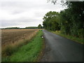

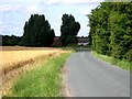
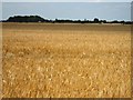
10 photos from this area
Area Information
Key information about the DN14 7XH including its size, population, and administrative classification.
- Area Type
- Postcode
- Area Size
- 2.8 km²
- Population
- 1867
- Population Density
- 37 people/km²
House Prices in DN14 7XH
31
Properties
£211,465
Average Sold Price
£54,000
Lowest Price
£624,358
Highest Price
Showing 31 properties
| Address | Type | Beds | Baths | Last Sale Price | Last Sale Date | |
|---|---|---|---|---|---|---|
| Linton Bridge House, Brow Lane, Balkholme, DN14 7XH | house | 5 | 2 | £624,358 | Oct 2022 | |
| Park Farm, Brow Lane, Balkholme, DN14 7XH | Detached | - | - | £76,000 | Jul 1997 | |
| Prosper Villa, Brow Lane, Balkholme, DN14 7XH | Detached | - | - | £54,000 | Mar 1997 | |
| Balkholme Hall, Brow Lane, Balkholme, DN14 7XH | Retail | 5 | - | £91,500 | Jun 1996 | |
| The Long House, Brow Lane, Balkholme, DN14 7XH | Detached | 2 | - | - | - | |
| Squirrel Lodge, Brow Lane, Balkholme, DN14 7XH | Cottage | 5 | - | - | - | |
| Pear Tree Cottage, Brow Lane, Balkholme, DN14 7XH | Detached | - | - | - | - | |
| Caravan, South Lea Stables, Brow Lane, Balkholme, DN14 7XH | Mobile Home | - | - | - | - | |
| Former Manor Farm Cross Country, Brow Lane, Balkholme, DN14 7XH | Leisure | - | - | - | - | |
| Overhead Line Replacement South West Of, West Linton Cottages, Brow Lane, Balkholme, DN14 7XH | Industrial | - | - | - | - |
Page 1 of 4
Energy Efficiency in DN14 7XH
Amenities
Schools
| Rank | School | Type | Entry gender | Ages |
|---|
Explore more schools in this area
Go to Schools tabDemographics
Household Size
Two person
most common
Accommodation Type
Houses
most common
Tenure
83
majority
Ethnic Group
White
most common
Religion
N/A
most common
Household Composition
N/A
most common
Age
47
median
Adults (30-64 years)
most common
Household Deprivation
N/A
with no deprivation
NS-SEC
37
in Lower managerial occupations
Explore more demographic insights in this area
Go to Demographics tabPlanning
Planning Constraints
- Flood RiskPremium
- Ramsar Wetland SitesPremium
- Area of Outstanding Natural BeautyPremium
- Protected Nature ReservePremium
- Protected WoodlandPremium