Area Overview for DN14 7PA
Photos of DN14 7PA

Area Information
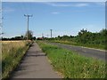
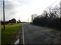
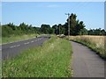
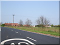
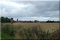
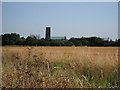
Living in DN14 7PA means being part of a small, tightly knit residential cluster in England. Covering just 11.3 hectares, this postcode area is compact, with a population of 1,867 people spread across 37 residents per square kilometre. It is a quiet, low-density area where the pace of life is measured, and community ties are likely strong. The presence of nearby rail stations, such as Howden and Eastrington, suggests easy access to regional transport networks, while the proximity to retail outlets like Tesco Rutland and Co-op Howden ensures daily essentials are within reach. Though small, the area balances residential tranquillity with practical connectivity, making it suitable for those seeking a peaceful yet accessible lifestyle. The demographic profile—primarily adults aged 30–64—hints at a mature, stable community, with a high rate of home ownership indicating long-term residency. For buyers, DN14 7PA offers a rare blend of seclusion and convenience, though its size means the housing stock is limited and choices may be constrained.
- Area Type
- Postcode
- Area Size
- 11.3 hectares
- Population
- 1867
- Population Density
- 37 people/km²
The property market in DN14 7PA is characterised by high home ownership, with 83% of residents living in owner-occupied homes. This suggests a stable, long-term market with limited rental activity, making it more of a buyer’s market than a rental one. The accommodation type is predominantly houses, which aligns with the area’s low density and suburban feel. Given the small size of the postcode area—just 11.3 hectares—the housing stock is likely limited, with few new developments. Buyers should expect a focus on existing properties rather than new builds, and the market may cater more to families seeking space than to investors or first-time buyers. The high home ownership rate also implies strong community ties, with residents likely to have lived in the area for many years. Prospective buyers should consider the limited availability of properties and the potential for competition among local residents.
House Prices in DN14 7PA
No properties found in this postcode.
Energy Efficiency in DN14 7PA
Residents of DN14 7PA have access to a modest but functional range of amenities. Within practical reach are five retail outlets, including Spar, Co-op Howden, and Tesco Rutland, ensuring everyday shopping needs are met without long trips. The presence of five rail stations—Howden, Eastrington, and Saltmarshe—adds to the area’s connectivity, though local leisure options are not detailed in the data. The compact size of the postcode area means amenities are concentrated, which can be both convenient and limiting. For those prioritising convenience, the proximity to shops and transport is a clear advantage. However, the lack of information on parks, dining, or recreational facilities leaves gaps in understanding the area’s lifestyle offerings. The retail and transport infrastructure suggest a practical, no-frills approach to daily life, with a focus on accessibility over luxury.
Amenities
Schools
The nearest school to DN14 7PA is Eastrington Primary School, which serves the local community with a good Ofsted rating. This primary school is the only educational institution listed in the data, meaning families in the area must rely on it for early education. The absence of secondary schools in the immediate vicinity suggests that parents may need to look beyond DN14 7PA for secondary education options. However, the good Ofsted rating indicates that the primary school provides a reliable foundation for young learners. For families prioritising strong local schools, the presence of a well-regarded primary institution is a positive, though the lack of secondary options may require planning for commuting or relocation. The school’s rating also reflects the area’s commitment to education, even within its small footprint.
| Rank | School | Type | Entry gender | Ages |
|---|
Explore more schools in this area
Go to Schools tabDemographics
The community in DN14 7PA is predominantly composed of adults aged 30–64, with a median age of 47. This suggests a mature population, likely with established careers and family ties. Home ownership is high, with 83% of residents owning their homes, indicating a stable, long-term demographic. The accommodation type is primarily houses, reflecting a suburban or semi-rural character rather than high-density housing. The predominant ethnic group is White, with no specific data provided on other ethnicities. The low population density—37 people per square kilometre—means the area is not densely populated, which aligns with the residential cluster description. This demographic profile suggests a community focused on family living, with a strong emphasis on property ownership and a slower, more deliberate pace of life. The absence of detailed diversity data means the area’s social composition remains largely unexplored in the provided information.
Household Size
Accommodation Type
Tenure
Ethnic Group
Religion
Household Composition
Age
Household Deprivation
NS-SEC
Explore more demographic insights in this area
Go to Demographics tabPlanning
Planning Constraints
- Flood RiskPremium
- Ramsar Wetland SitesPremium
- Area of Outstanding Natural BeautyPremium
- Protected Nature ReservePremium
- Protected WoodlandPremium