Area Overview for DN14 7ER
Photos of DN14 7ER
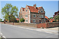
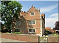
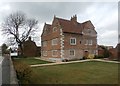
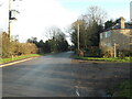
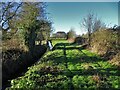
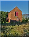
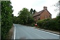
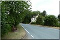
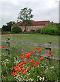
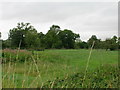
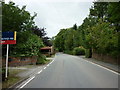
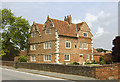
23 photos from this area
Area Information
Key information about the DN14 7ER including its size, population, and administrative classification.
- Area Type
- Postcode
- Area Size
- 35.7 hectares
- Population
- 1833
- Population Density
- 319 people/km²
House Prices in DN14 7ER
38
Properties
£268,653
Average Sold Price
£5,500
Lowest Price
£740,000
Highest Price
Showing 38 properties
| Address | Type | Beds | Baths | Last Sale Price | Last Sale Date | |
|---|---|---|---|---|---|---|
| 31 Knedlington Road, Howden, DN14 7ER | Bungalow | 3 | 2 | £215,000 | Jun 2024 | |
| 7 Knedlington Road, Howden, DN14 7ER | house | 4 | - | £275,000 | Feb 2024 | |
| Hornbeam House, 15 Knedlington Road, Howden, DN14 7ER | Bungalow | - | - | £5,500 | Aug 2023 | |
| Angels Way, Knedlington Road, Howden, DN14 7ER | Bungalow | - | - | £590,000 | Jan 2023 | |
| West View, 42 Knedlington Road, Howden, DN14 7ER | house | - | - | £740,000 | Jun 2021 | |
| 22 Knedlington Road, Howden, DN14 7ER | Bungalow | - | - | £340,000 | Mar 2021 | |
| 9 Knedlington Road, Howden, DN14 7ER | Detached | 4 | - | £287,000 | Feb 2020 | |
| 11 Knedlington Road, Howden, DN14 7ER | Semi-detached | 3 | 1 | £245,000 | Aug 2018 | |
| 13 Knedlington Road, Howden, DN14 7ER | Detached | 4 | 3 | £340,000 | Jul 2016 | |
| Martins, Knedlington Road, Howden, DN14 7ER | house | - | - | £451,000 | Jun 2016 |
Page 1 of 4
Energy Efficiency in DN14 7ER
Amenities
Schools
| Rank | School | Type | Entry gender | Ages |
|---|
Explore more schools in this area
Go to Schools tabDemographics
Household Size
One person
most common
Accommodation Type
Houses
most common
Tenure
67
majority
Ethnic Group
White
most common
Religion
N/A
most common
Household Composition
N/A
most common
Age
47
median
Adults (30-64 years)
most common
Household Deprivation
N/A
with no deprivation
NS-SEC
34
in Lower managerial occupations
Explore more demographic insights in this area
Go to Demographics tabPlanning
Planning Constraints
- Flood RiskPremium
- Ramsar Wetland SitesPremium
- Area of Outstanding Natural BeautyPremium
- Protected Nature ReservePremium
- Protected WoodlandPremium