Area Overview for DN14 7DY
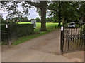
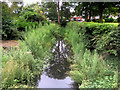
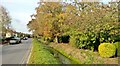
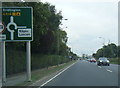
Photos of DN14 7DY


Area Information
DN14 7DY is a compact residential postcode in England, spanning 12.7 hectares and home to 1,786 residents. Its low population density of 117 people per square kilometre suggests a quiet, uncluttered living environment. The area is characterised by a mature community, with a median age of 47 and a majority of residents aged 30–64. This demographic hints at a stable, family-oriented neighbourhood where most homes are owner-occupied, with 90% of properties in private hands. The area’s small size means it is likely a close-knit cluster of houses, offering a sense of familiarity and proximity to local amenities. Residents benefit from nearby rail stations, including Howden and Goole, which provide easy access to larger towns and cities. While the area lacks major landmarks or commercial hubs, its simplicity and practicality appeal to those seeking a low-maintenance lifestyle with essential services within reach. The presence of Barmby-on-the-Marsh Primary School, rated ‘good’ by Ofsted, adds to its appeal for families. However, buyers should note the moderate flood risk, which is a key consideration for long-term residency.
- Area Type
- Postcode
- Area Size
- 12.7 hectares
- Population
- 1786
- Population Density
- 117 people/km²
DN14 7DY is almost entirely an owner-occupied area, with 90% of properties in private hands. This high home ownership rate suggests a stable, long-term resident base, likely composed of families and professionals who have established roots in the area. The accommodation type is exclusively houses, which is unusual for a small postcode but aligns with the low population density of 117 people per square kilometre. This housing stock implies a traditional, semi-rural character, with properties likely offering more space than typical urban flats. For buyers, this means a limited selection of properties, as the area is small and primarily residential. The absence of rental properties also indicates that the market is not geared toward short-term lets or investment. Prospective buyers should consider the area’s compact size and the need to look beyond DN14 7DY for more diverse housing options.
House Prices in DN14 7DY
Showing 30 properties
| Address | Type | Beds | Baths | Last Sale Price | Last Sale Date | |
|---|---|---|---|---|---|---|
| Ingledene, 11 Buttfield Road, Howden, DN14 7DY | Semi-detached | 2 | 1 | £200,000 | Feb 2025 | |
| 21 Buttfield Road, Howden, DN14 7DY | Bungalow | - | - | £205,000 | Sep 2022 | |
| 7A Buttfield Road, Howden, DN14 7DY | Retail | 2 | 1 | £185,000 | Aug 2022 | |
| 84 Buttfield Road, Howden, DN14 7DY | Bungalow | - | - | £196,000 | Aug 2021 | |
| 29 Buttfield Road, Howden, DN14 7DY | Semi-detached | 4 | - | £200,000 | May 2020 | |
| 35 Buttfield Road, Howden, DN14 7DY | Bungalow | - | - | £187,000 | Aug 2018 | |
| 31 Buttfield Road, Howden, DN14 7DY | Semi-detached | 2 | 1 | £195,000 | Jul 2018 | |
| 94 Buttfield Road, Howden, DN14 7DY | house | - | - | £241,500 | Feb 2018 | |
| 9 Buttfield Road, Howden, DN14 7DY | Semi-detached | 2 | 1 | £151,500 | Oct 2016 | |
| 92 Buttfield Road, Howden, DN14 7DY | Bungalow | - | - | £222,500 | Nov 2015 |
Energy Efficiency in DN14 7DY
The lifestyle in DN14 7DY is defined by its proximity to practical amenities. Local retail options include Co-op Howden, Spar, and Tesco Rutland, providing essential shopping needs within a short distance. The rail stations—Howden, Goole, and Saltmarshe—offer both commuting opportunities and access to nearby towns for dining, entertainment, and leisure. While the area itself does not list parks or recreational facilities, the rail links suggest that residents can easily reach larger areas with more amenities. The combination of retail outlets and transport options creates a functional daily life, though the small size of the postcode means that leisure and cultural activities may require travel. The presence of a primary school and the ease of rail travel indicate a community focused on practicality and connectivity over expansive leisure infrastructure.
Amenities
Schools
The nearest school to DN14 7DY is Barmby-on-the-Marsh Primary School, which serves the local community with a ‘good’ Ofsted rating. This school is the only educational institution explicitly listed in the data, suggesting that families with young children may need to look beyond the immediate area for secondary education. The presence of a primary school with a positive rating is a key asset for families, offering a reliable foundation for early education. However, the lack of secondary schools within the postcode means that parents should consider commuting to nearby towns for older children’s schooling. The school’s rating indicates a satisfactory standard of teaching and facilities, though it does not provide information on specific subjects or extracurricular offerings.
| Rank | School | Type | Entry gender | Ages |
|---|
Explore more schools in this area
Go to Schools tabDemographics
The population of DN14 7DY is predominantly adults aged 30–64, with a median age of 47. This suggests a community of established professionals and families, rather than a younger or elderly demographic. Home ownership is exceptionally high at 90%, indicating a strong local economy and long-term residency. The accommodation type is exclusively houses, which aligns with the area’s low density and residential character. The predominant ethnic group is White, reflecting a homogenous community. While no specific deprivation data is provided, the high home ownership rate and stable age profile imply a relatively secure quality of life. However, the absence of rental properties suggests limited flexibility for those seeking tenanted accommodation. The age range of residents also points to a community with fewer children in secondary education, which may influence local school demand and amenities.
Household Size
Accommodation Type
Tenure
Ethnic Group
Religion
Household Composition
Age
Household Deprivation
NS-SEC
Explore more demographic insights in this area
Go to Demographics tabPlanning
Planning Constraints
- Flood RiskPremium
- Ramsar Wetland SitesPremium
- Area of Outstanding Natural BeautyPremium
- Protected Nature ReservePremium
- Protected WoodlandPremium