Area Overview for DN14 5HQ
Photos of DN14 5HQ
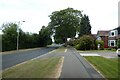
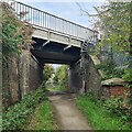
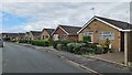
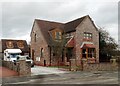
31 photos from this area
Area Information
Key information about the DN14 5HQ including its size, population, and administrative classification.
- Area Type
- Postcode
- Area Size
- 2.2 hectares
- Population
- 1787
- Population Density
- 7381 people/km²
House Prices in DN14 5HQ
13
Properties
£96,625
Average Sold Price
£29,000
Lowest Price
£145,000
Highest Price
Showing 13 properties
| Address | Type | Beds | Baths | Last Sale Price | Last Sale Date | |
|---|---|---|---|---|---|---|
| 51 Fountayne Street, Goole, DN14 5HQ | Semi-detached | 3 | 1 | £145,000 | Jul 2023 | |
| 55 Fountayne Street, Goole, DN14 5HQ | Semi-detached | 3 | 1 | £98,500 | Oct 2015 | |
| 59 Fountayne Street, Goole, DN14 5HQ | house | 3 | 1 | £132,500 | Nov 2007 | |
| 47 Fountayne Street, Goole, DN14 5HQ | Semi-detached | - | - | £130,000 | Mar 2007 | |
| 49 Fountayne Street, Goole, DN14 5HQ | house | - | - | £100,000 | Dec 2006 | |
| 53 Fountayne Street, Goole, DN14 5HQ | Semi-detached | - | - | £72,000 | Oct 2003 | |
| 61 Fountayne Street, Goole, DN14 5HQ | Semi-detached | - | - | £66,000 | Sep 2002 | |
| 67 Fountayne Street, Goole, DN14 5HQ | house | - | - | £29,000 | Sep 1998 | |
| 69 Fountayne Street, Goole, DN14 5HQ | Semi-detached | 3 | 1 | - | - | |
| 63 Fountayne Street, Goole, DN14 5HQ | house | - | - | - | - |
Page 1 of 2
Energy Efficiency in DN14 5HQ
Amenities
Schools
| Rank | School | Type | Entry gender | Ages |
|---|
Explore more schools in this area
Go to Schools tabDemographics
Household Size
Family (3-5 people)
most common
Accommodation Type
Houses
most common
Tenure
52
majority
Ethnic Group
White
most common
Religion
N/A
most common
Household Composition
N/A
most common
Age
47
median
Adults (30-64 years)
most common
Household Deprivation
N/A
with no deprivation
NS-SEC
13
in Lower managerial occupations
Explore more demographic insights in this area
Go to Demographics tabPlanning
Planning Constraints
- Flood RiskPremium
- Ramsar Wetland SitesPremium
- Area of Outstanding Natural BeautyPremium
- Protected Nature ReservePremium
- Protected WoodlandPremium