Area Overview for DN14 5AD
Photos of DN14 5AD
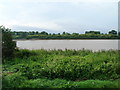
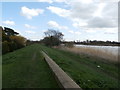
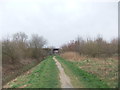
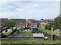
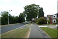
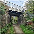
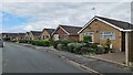
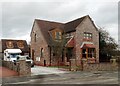
31 photos from this area
Area Information
Key information about the DN14 5AD including its size, population, and administrative classification.
- Area Type
- Postcode
- Area Size
- 2.0 hectares
- Population
- 1437
- Population Density
- 2281 people/km²
House Prices in DN14 5AD
55
Properties
£176,252
Average Sold Price
£64,500
Lowest Price
£328,000
Highest Price
Showing 55 properties
| Address | Type | Beds | Baths | Last Sale Price | Last Sale Date | |
|---|---|---|---|---|---|---|
| Grove House, 2A Olive Grove, Goole, DN14 5AD | Detached | 3 | 1 | £259,000 | Dec 2025 | |
| 28 Olive Grove, Goole, DN14 5AD | Terraced | 2 | 1 | £136,000 | Mar 2025 | |
| 39 Olive Grove, Goole, DN14 5AD | Flat | 2 | 2 | £108,900 | Dec 2024 | |
| 35 Olive Grove, Goole, DN14 5AD | Flat | 1 | 1 | £64,500 | Jul 2024 | |
| 18 Olive Grove, Goole, DN14 5AD | house | - | - | £187,000 | Apr 2024 | |
| 42 Olive Grove, Goole, DN14 5AD | Detached | 4 | 1 | £328,000 | Apr 2024 | |
| 11 Olive Grove, Goole, DN14 5AD | Detached | 4 | 3 | £280,000 | Mar 2024 | |
| 30 Olive Grove, Goole, DN14 5AD | Flat | - | - | £110,000 | May 2023 | |
| 15 Olive Grove, Goole, DN14 5AD | Detached | 4 | 3 | £294,000 | Oct 2022 | |
| 4 Olive Grove, Goole, DN14 5AD | house | - | - | £208,000 | Oct 2022 |
Page 1 of 6
Energy Efficiency in DN14 5AD
Amenities
Schools
| Rank | School | Type | Entry gender | Ages |
|---|
Explore more schools in this area
Go to Schools tabDemographics
Household Size
Two person
most common
Accommodation Type
Houses
most common
Tenure
63
majority
Ethnic Group
White
most common
Religion
N/A
most common
Household Composition
N/A
most common
Age
47
median
Adults (30-64 years)
most common
Household Deprivation
N/A
with no deprivation
NS-SEC
24
in Lower managerial occupations
Explore more demographic insights in this area
Go to Demographics tabPlanning
Planning Constraints
- Flood RiskPremium
- Ramsar Wetland SitesPremium
- Area of Outstanding Natural BeautyPremium
- Protected Nature ReservePremium
- Protected WoodlandPremium