Area Overview for DN14 0NE
Photos of DN14 0NE
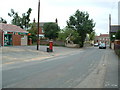
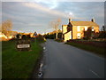


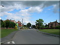

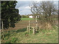


23 photos from this area
Area Information
Key information about the DN14 0NE including its size, population, and administrative classification.
- Area Type
- Postcode
- Area Size
- 3.5 hectares
- Population
- 1770
- Population Density
- 249 people/km²
House Prices in DN14 0NE
32
Properties
£236,288
Average Sold Price
£43,000
Lowest Price
£387,500
Highest Price
Showing 32 properties
| Address | Type | Beds | Baths | Last Sale Price | Last Sale Date | |
|---|---|---|---|---|---|---|
| Manor Farm Orchard, Main Street, Kellington, DN14 0NE | house | - | - | £322,500 | May 2021 | |
| Lyndon House, Main Street, Kellington, DN14 0NE | Detached | 4 | - | £375,000 | Feb 2019 | |
| Orchard House, Main Street, Kellington, DN14 0NE | Detached | 4 | - | £260,000 | Jun 2018 | |
| Kirk View, Main Street, Kellington, DN14 0NE | Detached | 5 | 1 | £387,500 | Nov 2016 | |
| Low Field House, Main Street, Kellington, DN14 0NE | Detached | 5 | 1 | £355,000 | Dec 2015 | |
| Wayside Cottage, Main Street, Kellington, DN14 0NE | house | - | - | £231,000 | Mar 2011 | |
| The Bungalow, Main Street, Kellington, DN14 0NE | Semi-detached | - | - | £124,950 | Jul 2008 | |
| The Hawthorns, Main Street, Kellington, DN14 0NE | Detached | 3 | 2 | £232,500 | Dec 2007 | |
| Chelfonts, Main Street, Kellington, DN14 0NE | Detached | - | - | £252,000 | Jul 2007 | |
| 3 Main Street, Kellington, DN14 0NE | Semi-detached | - | - | £164,000 | Oct 2005 |
Page 1 of 4
Energy Efficiency in DN14 0NE
Amenities
Schools
| Rank | School | Type | Entry gender | Ages |
|---|
Explore more schools in this area
Go to Schools tabDemographics
Household Size
Two person
most common
Accommodation Type
Houses
most common
Tenure
71
majority
Ethnic Group
White
most common
Religion
N/A
most common
Household Composition
N/A
most common
Age
47
median
Adults (30-64 years)
most common
Household Deprivation
N/A
with no deprivation
NS-SEC
27
in Lower managerial occupations
Explore more demographic insights in this area
Go to Demographics tabPlanning
Planning Constraints
- Flood RiskPremium
- Ramsar Wetland SitesPremium
- Area of Outstanding Natural BeautyPremium
- Protected Nature ReservePremium
- Protected WoodlandPremium