Area Overview for DN14 0DE
Photos of DN14 0DE
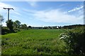
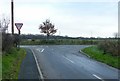
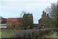
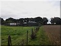
24 photos from this area
Area Information
Key information about the DN14 0DE including its size, population, and administrative classification.
- Area Type
- Postcode
- Area Size
- 1.1 km²
- Population
- 1338
- Population Density
- 104 people/km²
House Prices in DN14 0DE
20
Properties
£25,000
Average Sold Price
£25,000
Lowest Price
£25,000
Highest Price
Showing 20 properties
| Address | Type | Beds | Baths | Last Sale Price | Last Sale Date | |
|---|---|---|---|---|---|---|
| Caravan, The Sandpit, Pontefract Road, Snaith, DN14 0DE | Mobile Home | - | - | £25,000 | Sep 2016 | |
| Old Station House, Dorr Lane, Pollington, DN14 0DE | Detached | 5 | 3 | - | - | |
| Hall Bros Bridlington Limited, Pontefract Road, Snaith, DN14 0DE | warehouse | - | - | - | - | |
| Lewis Tank Transport Limited, Office G11, Big Picture House, Pontefract Road, Snaith, DN14 0DE | Office | - | - | - | - | |
| One Tree Paddock, Pontefract Road, Snaith, DN14 0DE | Mobile Home | - | - | - | - | |
| Metrail Construction Limited, Offices 1G And 1H, Big Picture House, Pontefract Road, Snaith, DN14 0DE | Office | - | - | - | - | |
| Acorn Farm Caravan, Dorr Lane, Snaith, DN14 0DE | Mobile Home | - | - | - | - | |
| Roger Miles Plant Sales, Pontefract Road, Snaith, DN14 0DE | warehouse | - | - | - | - | |
| A J Bathroom Solutions, Workshop 3, Pontefract Road, Snaith, DN14 0DE | Industrial | - | - | - | - | |
| Miles Leslie Properties, Miles Leslie Properties Store, Pontefract Road, Snaith, DN14 0DE | warehouse | - | - | - | - |
Page 1 of 2
Energy Efficiency in DN14 0DE
Amenities
Schools
| Rank | School | Type | Entry gender | Ages |
|---|
Explore more schools in this area
Go to Schools tabDemographics
Household Size
Two person
most common
Accommodation Type
Houses
most common
Tenure
89
majority
Ethnic Group
White
most common
Religion
N/A
most common
Household Composition
N/A
most common
Age
47
median
Adults (30-64 years)
most common
Household Deprivation
N/A
with no deprivation
NS-SEC
34
in Lower managerial occupations
Explore more demographic insights in this area
Go to Demographics tabPlanning
Planning Constraints
- Flood RiskPremium
- Ramsar Wetland SitesPremium
- Area of Outstanding Natural BeautyPremium
- Protected Nature ReservePremium
- Protected WoodlandPremium