Area Overview for DN12 3BT
Photos of DN12 3BT
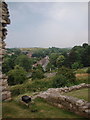
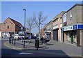
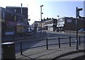
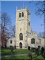
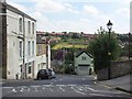
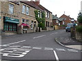
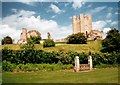
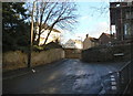
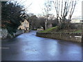
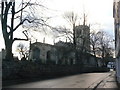
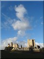
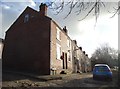
100 photos from this area
Area Information
Key information about the DN12 3BT including its size, population, and administrative classification.
- Area Type
- Postcode
- Area Size
- 1.3 hectares
- Population
- Not available
- Population Density
- Not available
House Prices in DN12 3BT
9
Properties
£140,708
Average Sold Price
£50,000
Lowest Price
£229,250
Highest Price
Showing 9 properties
| Address | Type | Beds | Baths | Last Sale Price | Last Sale Date | |
|---|---|---|---|---|---|---|
| The Terrace Coach House, Castle Avenue, Conisbrough, Doncaster, DN12 3BT | Detached | 4 | 2 | £229,250 | Jul 2024 | |
| 3 Castle Avenue, Conisbrough, Doncaster, DN12 3BT | house | - | - | £175,000 | Mar 2022 | |
| Coeben Cottage, Castle Avenue, Conisbrough, Doncaster, DN12 3BT | Detached | 3 | 2 | £190,000 | Jun 2020 | |
| 1 Castle Avenue, Conisbrough, Doncaster, DN12 3BT | house | - | - | £50,000 | Feb 2016 | |
| 2 Castle Avenue, Conisbrough, Doncaster, DN12 3BT | Terraced | 3 | 2 | £65,000 | Mar 2013 | |
| 6 Castle Avenue, Conisbrough, Doncaster, DN12 3BT | Detached | - | - | £135,000 | Aug 2001 | |
| 8 Castle Avenue, Conisbrough, Doncaster, DN12 3BT | house | - | - | - | - | |
| 4 Castle Avenue, Conisbrough, Doncaster, DN12 3BT | Semi-detached | - | - | - | - | |
| The Terrace, Castle Avenue, Conisbrough, Doncaster, DN12 3BT | community_day_centre | - | - | - | - |
Energy Efficiency in DN12 3BT
Amenities
Schools
| Rank | School | Type | Entry gender | Ages |
|---|
Explore more schools in this area
Go to Schools tabDemographics
Household Size
One person
most common
Accommodation Type
Houses
most common
Tenure
68
majority
Ethnic Group
White
most common
Religion
N/A
most common
Household Composition
N/A
most common
Age
47
median
Adults (30-64 years)
most common
Household Deprivation
N/A
with no deprivation
NS-SEC
26
in Lower managerial occupations
Explore more demographic insights in this area
Go to Demographics tabPlanning
Planning Constraints
- Flood RiskPremium
- Ramsar Wetland SitesPremium
- Area of Outstanding Natural BeautyPremium
- Protected Nature ReservePremium
- Protected WoodlandPremium