Area Overview for DN11 0WB
Photos of DN11 0WB


Area Information
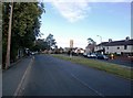
DN11 0WB is a small, residential postcode area in England, home to 1,720 people. Its compact size means it is a tight-knit community, with homes clustered closely together. The area’s character is defined by its mature population, with a median age of 47 and a strong presence of adults aged 30–64. This suggests a stable, established community where many residents may have lived for years. Daily life here is shaped by proximity to essential services, including shops, transport links, and schools. The area’s broadband score of 100 ensures seamless internet connectivity, while nearby rail stations and an airport provide easy access to regional hubs. Despite its small size, DN11 0WB offers a practical balance of residential living and accessibility. The low flood risk and absence of environmental constraints like protected woodlands or AONBs make it a straightforward place to live. However, crime rates are average, requiring standard precautions. For those seeking a quiet, functional home with good infrastructure, this area provides a viable option.
- Area Type
- Postcode
- Area Size
- Not available
- Population
- 1720
- Population Density
- 5495 people/km²
DN11 0WB’s property market is characterised by a 43% home ownership rate, meaning that just over a third of properties are owner-occupied. This suggests a significant rental market, with many homes available for lease. The accommodation type is predominantly houses, which may indicate a preference for larger, standalone properties over flats or terraced homes. This could appeal to families or individuals seeking more space. As a small area, the housing stock is likely limited, with homes concentrated in a compact cluster. For buyers, this means competition may be fierce, and properties could be in high demand. The lack of planning constraints, such as protected woodlands or AONBs, may also make development or renovation more straightforward. However, the owner-occupier proportion is relatively low, which could affect property value trends. Those considering purchase should weigh the balance between rental availability and long-term investment potential in this small, established area.
House Prices in DN11 0WB
No properties found in this postcode.
Energy Efficiency in DN11 0WB
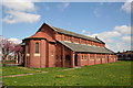
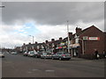
Residents of DN11 0WB have access to a range of nearby amenities, including five retail outlets such as Heron Rossington, Asda Rossington, and Co-op Rossington. These shops provide essential services, from groceries to general retail, supporting daily convenience. The proximity to the Robin Hood Doncaster Sheffield Airport and three railway stations enhances mobility, making it easier to travel for work, leisure, or visiting family. While the area lacks detailed information on parks or leisure facilities, the presence of retail and transport options suggests a practical, community-focused lifestyle. The small size of the postcode means amenities are within walking or short driving distance, reducing the need for long commutes. This balance of retail, transport, and connectivity contributes to a functional, accessible way of life for residents.
Amenities
Schools
Residents of DN11 0WB have access to two primary schools within reach: Grange Lane Infant School and Grange Lane Infant Academy. The latter is an academy with an outstanding Ofsted rating, reflecting high standards of education and performance. The presence of both a traditional primary school and an academy offers families choice in educational approaches, though both cater to younger children. This suggests the area is well-served for primary education, which is critical for families with young children. The absence of secondary schools in the data implies that older students may need to travel to nearby towns for further education. Nonetheless, the quality of the primary schools, particularly the academy’s rating, is a strong point for the area. Families prioritising strong early education will find DN11 0WB a viable option, though they should plan for secondary schooling elsewhere.
| Rank | School | Type | Entry gender | Ages |
|---|
Explore more schools in this area
Go to Schools tabDemographics
The population of DN11 0WB is predominantly adults aged 30–64, with a median age of 47. This suggests a mature, settled community, likely with a mix of long-term residents and families. Home ownership stands at 43%, indicating that nearly half of properties are owner-occupied, while the remaining 57% are likely rented. The accommodation type is primarily houses, which may reflect a preference for single-family homes over flats or apartments. The predominant ethnic group is White, with no specific data on other demographics. The absence of detailed diversity metrics means the community’s composition is not fully outlined, but the age profile implies a focus on middle-aged and older residents. This demographic may influence local amenities, such as the presence of primary schools and retail outlets tailored to family needs. The area’s stability is evident in its low flood risk and lack of environmental restrictions, which align with the lifestyle of its residents.
Household Size
Accommodation Type
Tenure
Ethnic Group
Religion
Household Composition
Age
Household Deprivation
NS-SEC
Explore more demographic insights in this area
Go to Demographics tabPlanning
Planning Constraints
- Flood RiskPremium
- Ramsar Wetland SitesPremium
- Area of Outstanding Natural BeautyPremium
- Protected Nature ReservePremium
- Protected WoodlandPremium