Area Overview for DN11 0SP
Photos of DN11 0SP
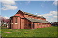
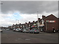

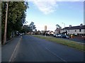
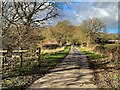
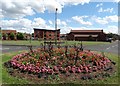
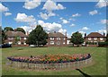
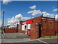
22 photos from this area
Area Information
Key information about the DN11 0SP including its size, population, and administrative classification.
- Area Type
- Postcode
- Area Size
- 1.1 hectares
- Population
- 1720
- Population Density
- 5495 people/km²
House Prices in DN11 0SP
43
Properties
£56,408
Average Sold Price
£12,972
Lowest Price
£96,500
Highest Price
Showing 43 properties
| Address | Type | Beds | Baths | Last Sale Price | Last Sale Date | |
|---|---|---|---|---|---|---|
| 3 Streatfield Crescent, New Rossington, Doncaster, DN11 0SP | Terraced | 1 | 1 | £65,000 | May 2024 | |
| 28 Streatfield Crescent, New Rossington, Doncaster, DN11 0SP | Retail | 3 | 1 | £96,500 | Aug 2022 | |
| 31 Streatfield Crescent, New Rossington, Doncaster, DN11 0SP | house | 3 | 1 | £80,000 | Dec 2021 | |
| 42 Streatfield Crescent, New Rossington, Doncaster, DN11 0SP | house | 3 | 1 | £78,000 | Dec 2018 | |
| 19 Streatfield Crescent, New Rossington, Doncaster, DN11 0SP | Terraced | 3 | 1 | £70,000 | Sep 2018 | |
| 32 Streatfield Crescent, New Rossington, Doncaster, DN11 0SP | Terraced | 3 | 1 | £82,000 | Aug 2018 | |
| 11 Streatfield Crescent, New Rossington, Doncaster, DN11 0SP | Terraced | 3 | 1 | £67,000 | Jan 2016 | |
| 12 Streatfield Crescent, New Rossington, Doncaster, DN11 0SP | Terraced | 3 | 1 | £56,000 | Sep 2015 | |
| 35 Streatfield Crescent, New Rossington, Doncaster, DN11 0SP | Terraced | 3 | 2 | £79,995 | Jan 2014 | |
| 37 Streatfield Crescent, New Rossington, Doncaster, DN11 0SP | Terraced | 3 | - | £65,000 | Aug 2013 |
Page 1 of 5
Energy Efficiency in DN11 0SP
Amenities
Schools
| Rank | School | Type | Entry gender | Ages |
|---|
Explore more schools in this area
Go to Schools tabDemographics
Household Size
Family (3-5 people)
most common
Accommodation Type
Houses
most common
Tenure
43
majority
Ethnic Group
White
most common
Religion
N/A
most common
Household Composition
N/A
most common
Age
47
median
Adults (30-64 years)
most common
Household Deprivation
N/A
with no deprivation
NS-SEC
14
in Lower managerial occupations
Explore more demographic insights in this area
Go to Demographics tabPlanning
Planning Constraints
- Flood RiskPremium
- Ramsar Wetland SitesPremium
- Area of Outstanding Natural BeautyPremium
- Protected Nature ReservePremium
- Protected WoodlandPremium