Area Overview for DN11 0FJ
Photos of DN11 0FJ
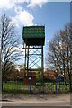
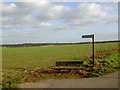


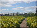
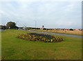
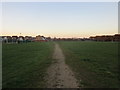
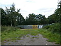
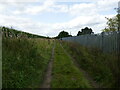

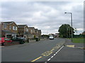
18 photos from this area
Area Information
Key information about the DN11 0FJ including its size, population, and administrative classification.
- Area Type
- Postcode
- Area Size
- 7336 m²
- Population
- 1958
- Population Density
- 397 people/km²
House Prices in DN11 0FJ
17
Properties
£193,476
Average Sold Price
£69,450
Lowest Price
£350,000
Highest Price
Showing 17 properties
| Address | Type | Beds | Baths | Last Sale Price | Last Sale Date | |
|---|---|---|---|---|---|---|
| 29 Tickhill Way, Rossington, Doncaster, DN11 0FJ | Detached | 4 | 2 | £350,000 | Aug 2024 | |
| 3 Tickhill Way, Rossington, Doncaster, DN11 0FJ | house | 4 | 3 | £270,000 | Jun 2024 | |
| 33 Tickhill Way, Rossington, Doncaster, DN11 0FJ | Detached | 3 | 2 | £230,000 | Dec 2021 | |
| 17 Tickhill Way, Rossington, Doncaster, DN11 0FJ | house | - | - | £295,000 | Sep 2021 | |
| 31 Tickhill Way, Rossington, Doncaster, DN11 0FJ | Detached | 3 | - | £203,000 | Aug 2021 | |
| 9 Tickhill Way, Rossington, Doncaster, DN11 0FJ | house | - | - | £290,000 | May 2021 | |
| 25 Tickhill Way, Rossington, Doncaster, DN11 0FJ | house | - | - | £260,000 | Dec 2020 | |
| 27 Tickhill Way, Rossington, Doncaster, DN11 0FJ | Detached | 4 | - | £200,000 | Aug 2018 | |
| 7 Tickhill Way, Rossington, Doncaster, DN11 0FJ | Detached | - | - | £218,000 | Sep 2012 | |
| 5 Tickhill Way, Rossington, Doncaster, DN11 0FJ | house | - | - | £173,500 | Sep 2009 |
Page 1 of 2
Energy Efficiency in DN11 0FJ
Amenities
Schools
| Rank | School | Type | Entry gender | Ages |
|---|
Explore more schools in this area
Go to Schools tabDemographics
Household Size
Two person
most common
Accommodation Type
Houses
most common
Tenure
81
majority
Ethnic Group
White
most common
Religion
N/A
most common
Household Composition
N/A
most common
Age
47
median
Adults (30-64 years)
most common
Household Deprivation
N/A
with no deprivation
NS-SEC
35
in Lower managerial occupations
Explore more demographic insights in this area
Go to Demographics tabPlanning
Planning Constraints
- Flood RiskPremium
- Ramsar Wetland SitesPremium
- Area of Outstanding Natural BeautyPremium
- Protected Nature ReservePremium
- Protected WoodlandPremium