Area Overview for DL8 3QJ
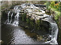
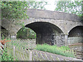
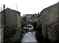
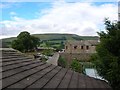
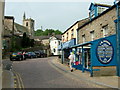
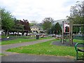
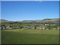
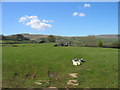
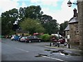
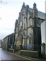
Photos of DL8 3QJ


Area Information
DL8 3QJ is a small, low-density residential postcode area in England, home to 1,220 people spread across 9 people per square kilometre. This makes it a quiet, sparsely populated cluster, ideal for those seeking a peaceful, mature community. The area is characterised by a predominance of houses, with 75% of residents owning their homes. Daily life here is likely to be slow-paced, with a strong emphasis on local amenities and proximity to essential services. The presence of two primary schools within reach suggests a family-friendly environment, while the low crime risk score of 90 indicates a safe neighbourhood. Residents benefit from a nearby railway station at Garsdale, offering rail connectivity, though broadband quality remains a consideration. The area’s small size means it is likely to be surrounded by open spaces or rural landscapes, though specific details on natural surroundings are not provided. For buyers, DL8 3QJ offers a blend of stability, safety, and a close-knit community, though its limited scale may appeal more to those prioritising tranquillity over urban convenience.
- Area Type
- Postcode
- Area Size
- Not available
- Population
- 1220
- Population Density
- 9 people/km²
DL8 3QJ is a predominantly owner-occupied area, with 75% of residents living in homes they own. The accommodation type is exclusively houses, which is unusual for a small postcode area but may reflect its low density and potential rural character. This suggests a housing stock focused on single-family homes rather than flats or apartments, which could appeal to buyers seeking space and privacy. The limited size of the area means the property market is likely small, with few options available. However, the high home ownership rate indicates a stable market where properties may retain value. For buyers, this area may offer a niche opportunity to purchase a house in a quiet, low-density setting, though the lack of rental properties suggests it is not a hotspot for investors. The proximity to Garsdale Railway Station may enhance its appeal for commuters, though the broadband quality could be a concern for those reliant on home internet.
House Prices in DL8 3QJ
No properties found in this postcode.
Energy Efficiency in DL8 3QJ
The lifestyle in DL8 3QJ is shaped by its small size and limited amenities. The nearest retail option is a Spar store, offering basic groceries and essentials, which suggests a minimal shopping experience for residents. The presence of Garsdale Railway Station adds a layer of connectivity, allowing access to broader services and employment opportunities beyond the immediate area. However, the data does not mention parks, leisure facilities, or dining options, implying that recreational activities may be limited to nearby natural spaces or require travel to larger towns. The area’s character appears to be one of simplicity and convenience, with amenities focused on practicality rather than luxury. For those prioritising a quiet, self-sufficient lifestyle, the Spar and rail station provide sufficient daily necessities, though the lack of detailed information on leisure options means the full extent of the area’s appeal remains to be explored.
Amenities
Schools
Residents of DL8 3QJ have access to two primary schools within practical reach: Hawes Community Primary School and Hawes Primary School, which holds a ‘good’ Ofsted rating. Both institutions serve the local community, providing education for younger children in the area. The presence of two primary schools suggests a focus on family-friendly infrastructure, though no secondary schools are listed in the data. The ‘good’ rating at Hawes Primary School indicates a reasonably high standard of education, which could be a key consideration for families. However, the absence of additional schools or information on their performance means the full educational landscape of the area remains unclear. For parents, the availability of two primary schools within reach offers convenience, but further research would be needed to assess the quality of secondary education in the surrounding region.
| Rank | School | Type | Entry gender | Ages |
|---|
Explore more schools in this area
Go to Schools tabDemographics
The population of DL8 3QJ is predominantly adults aged 30–64, with a median age of 47. This suggests a mature, established community with a focus on long-term residency. Home ownership is high, at 75%, indicating a stable housing market where most residents live in their own homes. The accommodation type is primarily houses, which aligns with the area’s low density and likely rural or semi-rural setting. The predominant ethnic group is White, though no specific data on diversity or deprivation is available. The age profile implies a population that is likely to be in or nearing retirement, with fewer young families or students. This demographic may influence local services, such as healthcare and leisure facilities, though specific details are not provided. The absence of data on deprivation means the area’s quality of life cannot be assessed in that regard, but the high home ownership rate and low crime risk suggest a generally stable environment.
Household Size
Accommodation Type
Tenure
Ethnic Group
Religion
Household Composition
Age
Household Deprivation
NS-SEC
Explore more demographic insights in this area
Go to Demographics tabPlanning
Planning Constraints
- Flood RiskPremium
- Ramsar Wetland SitesPremium
- Area of Outstanding Natural BeautyPremium
- Protected Nature ReservePremium
- Protected WoodlandPremium