Area Overview for DL8 3AB
Photos of DL8 3AB
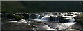
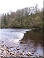
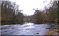
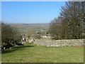
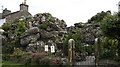
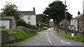
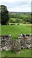
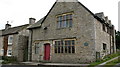
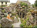
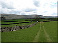
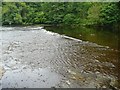
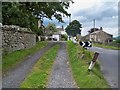
100 photos from this area
Area Information
Key information about the DL8 3AB including its size, population, and administrative classification.
- Area Type
- Postcode
- Area Size
- 9.5 hectares
- Population
- 1319
- Population Density
- 13 people/km²
House Prices in DL8 3AB
18
Properties
£301,900
Average Sold Price
£84,000
Lowest Price
£655,000
Highest Price
Showing 18 properties
| Address | Type | Beds | Baths | Last Sale Price | Last Sale Date | |
|---|---|---|---|---|---|---|
| Greystones, Main Street, Aysgarth, DL8 3AB | house | - | - | £650,000 | Aug 2022 | |
| Marlbeck, Doctor Lane, Aysgarth, DL8 3AB | Terraced | 4 | 1 | £390,000 | Dec 2019 | |
| Well View House, Doctor Lane, Aysgarth, DL8 3AB | house | - | - | £655,000 | Aug 2018 | |
| Stonecroft, Main Street, Aysgarth, DL8 3AB | house | - | - | £240,000 | Dec 2017 | |
| Lindow Cottage, Main Street, Aysgarth, DL8 3AB | house | - | - | £285,000 | Jan 2017 | |
| The Stable, Main Street, Aysgarth, DL8 3AB | house | 1 | - | £120,000 | Mar 2014 | |
| Kevock Cottage, Doctor Lane, Aysgarth, DL8 3AB | house | 3 | - | £250,000 | Aug 2010 | |
| Dale Cottage, Doctor Lane, Aysgarth, DL8 3AB | Detached | - | - | £210,000 | Nov 2003 | |
| Thordale, Main Street, Aysgarth, DL8 3AB | Semi-detached | - | - | £84,000 | Aug 1997 | |
| Field House, Doctor Lane, Aysgarth, DL8 3AB | Detached | - | - | £135,000 | Apr 1997 |
Page 1 of 2
Energy Efficiency in DL8 3AB
Amenities
Schools
| Rank | School | Type | Entry gender | Ages |
|---|
Explore more schools in this area
Go to Schools tabDemographics
Household Size
Two person
most common
Accommodation Type
Houses
most common
Tenure
71
majority
Ethnic Group
White
most common
Religion
N/A
most common
Household Composition
N/A
most common
Age
47
median
Adults (30-64 years)
most common
Household Deprivation
N/A
with no deprivation
NS-SEC
34
in Lower managerial occupations
Explore more demographic insights in this area
Go to Demographics tabPlanning
Planning Constraints
- Flood RiskPremium
- Ramsar Wetland SitesPremium
- Area of Outstanding Natural BeautyPremium
- Protected Nature ReservePremium
- Protected WoodlandPremium