Area Overview for DL8 2SJ
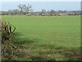
Photos of DL8 2SJ
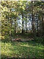
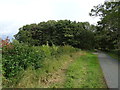
![Scroggs Lane [B6268] in DL8 2SJ](https://images.propbar.co.uk/images/geograph/56/98/5698487_120.jpg)

15 photos from this area
Area Information
Key information about the DL8 2SJ including its size, population, and administrative classification.
- Area Type
- Postcode
- Area Size
- 48.7 hectares
- Population
- 1714
- Population Density
- 28 people/km²
House Prices in DL8 2SJ
2
Properties
£119,250
Average Sold Price
£65,500
Lowest Price
£173,000
Highest Price
Showing 2 properties
| Address | Type | Beds | Baths | Last Sale Price | Last Sale Date | |
|---|---|---|---|---|---|---|
| 1, Watlass Moor Cottages, Scroggs Lane, Snape, DL8 2SJ | Semi-detached | - | - | £173,000 | Oct 2002 | |
| 2, Watlass Moor Cottages, Scroggs Lane, Snape, DL8 2SJ | Semi-detached | - | - | £65,500 | Jun 2001 |
Energy Efficiency in DL8 2SJ
Amenities
Schools
| Rank | School | Type | Entry gender | Ages |
|---|
Explore more schools in this area
Go to Schools tabDemographics
Household Size
Two person
most common
Accommodation Type
Houses
most common
Tenure
70
majority
Ethnic Group
White
most common
Religion
N/A
most common
Household Composition
N/A
most common
Age
47
median
Adults (30-64 years)
most common
Household Deprivation
N/A
with no deprivation
NS-SEC
38
in Lower managerial occupations
Explore more demographic insights in this area
Go to Demographics tabPlanning
Planning Constraints
- Flood RiskPremium
- Ramsar Wetland SitesPremium
- Area of Outstanding Natural BeautyPremium
- Protected Nature ReservePremium
- Protected WoodlandPremium