Area Overview for DL8 1SF
Photos of DL8 1SF
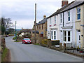
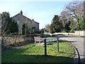
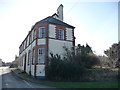
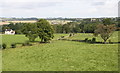
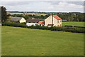


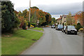
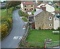
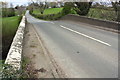
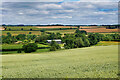
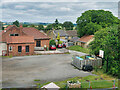
31 photos from this area
Area Information
Key information about the DL8 1SF including its size, population, and administrative classification.
- Area Type
- Postcode
- Area Size
- 2.3 hectares
- Population
- 1498
- Population Density
- 23 people/km²
House Prices in DL8 1SF
14
Properties
£199,249
Average Sold Price
£89,750
Lowest Price
£275,000
Highest Price
Showing 14 properties
| Address | Type | Beds | Baths | Last Sale Price | Last Sale Date | |
|---|---|---|---|---|---|---|
| Angleham, Bedale Road, Newton Le Willows, DL8 1SF | Bungalow | 3 | 1 | £235,000 | Mar 2025 | |
| Belmont, Bedale Road, Newton Le Willows, DL8 1SF | Bungalow | 4 | - | £275,000 | Feb 2024 | |
| Swiss Cottage, Bedale Road, Newton Le Willows, DL8 1SF | Detached | 3 | 1 | £249,995 | Nov 2019 | |
| Low Wood House, Bedale Road, Newton Le Willows, DL8 1SF | Detached | 4 | 2 | £235,000 | Sep 2012 | |
| Sandycroft, Bedale Road, Newton Le Willows, DL8 1SF | Detached | - | - | £115,000 | Nov 2005 | |
| Thwaite Cottage, Bedale Road, Newton Le Willows, DL8 1SF | house | - | - | £195,000 | Jul 2004 | |
| Sandy Cottage, Bedale Road, Newton Le Willows, DL8 1SF | Semi-detached | - | - | £89,750 | Aug 2001 | |
| 2, Sandycroft, Bedale Road, Newton Le Willows, DL8 1SF | Semi-detached | - | - | - | - | |
| 1, Sandycroft, Bedale Road, Newton Le Willows, DL8 1SF | Land | - | - | - | - | |
| Greenacres, Bedale Road, Newton Le Willows, DL8 1SF | Detached | - | - | - | - |
Page 1 of 2
Energy Efficiency in DL8 1SF
Amenities
Schools
| Rank | School | Type | Entry gender | Ages |
|---|
Explore more schools in this area
Go to Schools tabDemographics
Household Size
Two person
most common
Accommodation Type
Houses
most common
Tenure
72
majority
Ethnic Group
White
most common
Religion
N/A
most common
Household Composition
N/A
most common
Age
47
median
Adults (30-64 years)
most common
Household Deprivation
N/A
with no deprivation
NS-SEC
41
in Lower managerial occupations
Explore more demographic insights in this area
Go to Demographics tabPlanning
Planning Constraints
- Flood RiskPremium
- Ramsar Wetland SitesPremium
- Area of Outstanding Natural BeautyPremium
- Protected Nature ReservePremium
- Protected WoodlandPremium