Area Overview for DL8 1AT
Photos of DL8 1AT
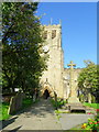


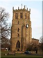

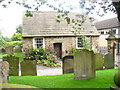
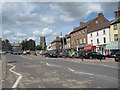
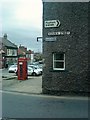
100 photos from this area
Area Information
Key information about the DL8 1AT including its size, population, and administrative classification.
- Area Type
- Postcode
- Area Size
- 1.8 hectares
- Population
- 2007
- Population Density
- 416 people/km²
House Prices in DL8 1AT
41
Properties
£196,543
Average Sold Price
£79,950
Lowest Price
£325,000
Highest Price
Showing 41 properties
| Address | Type | Beds | Baths | Last Sale Price | Last Sale Date | |
|---|---|---|---|---|---|---|
| 26 Ascough Wynd, Aiskew, DL8 1AT | Detached | 3 | 2 | £265,000 | Nov 2025 | |
| 21 Ascough Wynd, Aiskew, DL8 1AT | Terraced | 2 | 1 | £172,000 | Aug 2025 | |
| 9 Ascough Wynd, Aiskew, DL8 1AT | Terraced | 4 | 2 | £265,000 | Jun 2024 | |
| 18 Ascough Wynd, Aiskew, DL8 1AT | Terraced | 4 | 2 | £325,000 | May 2024 | |
| 10 Ascough Wynd, Aiskew, DL8 1AT | Terraced | 4 | 2 | £255,000 | Nov 2023 | |
| 37 Ascough Wynd, Aiskew, DL8 1AT | Terraced | 3 | 2 | £225,000 | Sep 2023 | |
| 32 Ascough Wynd, Aiskew, DL8 1AT | house | - | - | £230,000 | Dec 2022 | |
| 34 Ascough Wynd, Aiskew, DL8 1AT | house | - | - | £231,000 | Jul 2022 | |
| 27 Ascough Wynd, Aiskew, DL8 1AT | house | - | - | £230,000 | Mar 2022 | |
| 29 Ascough Wynd, Aiskew, DL8 1AT | house | - | - | £165,000 | Dec 2021 |
Page 1 of 5
Energy Efficiency in DL8 1AT
Amenities
Schools
| Rank | School | Type | Entry gender | Ages |
|---|
Explore more schools in this area
Go to Schools tabDemographics
Household Size
Two person
most common
Accommodation Type
Houses
most common
Tenure
70
majority
Ethnic Group
White
most common
Religion
N/A
most common
Household Composition
N/A
most common
Age
47
median
Adults (30-64 years)
most common
Household Deprivation
N/A
with no deprivation
NS-SEC
35
in Lower managerial occupations
Explore more demographic insights in this area
Go to Demographics tabPlanning
Planning Constraints
- Flood RiskPremium
- Ramsar Wetland SitesPremium
- Area of Outstanding Natural BeautyPremium
- Protected Nature ReservePremium
- Protected WoodlandPremium