Area Overview for DL8 1AG
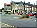
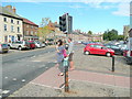
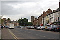
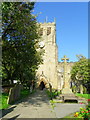
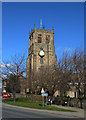
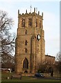
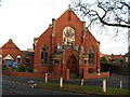
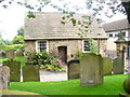
Photos of DL8 1AG


Area Information
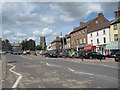
DL8 1AG is a small, tightly knit residential cluster in England, home to 1,712 people spread across a compact area. With a population density of 271 people per square kilometre, the community feels close-knit yet unovercrowded. This is a place where daily life revolves around local amenities and familiar faces. The area’s character is defined by its quiet, suburban charm, with homes predominantly owner-occupied and a median age of 47 suggesting a stable, mature population. Residents are likely to be professionals, families, or retirees seeking a balanced lifestyle. The proximity to Bedale, a nearby town, offers access to services without the bustle of a larger city. For those considering living here, the low crime score of 82/100 and absence of environmental constraints make it an attractive option for buyers prioritising safety and practicality. The area’s small size means it’s ideal for those who value convenience, with most needs within walking or short driving distance.
- Area Type
- Postcode
- Area Size
- Not available
- Population
- 1712
- Population Density
- 271 people/km²
DL8 1AG is primarily an owner-occupied area, with 68% of homes owned by residents rather than rented out. The accommodation types here are predominantly houses, which is typical for smaller, suburban postcode areas. This suggests a market skewed towards family homes and long-term residency rather than short-term rental properties. The small size of the area means the housing stock is limited, which could make it a competitive market for buyers. The high home ownership rate indicates stability, with fewer turnover rates compared to rental-heavy regions. For those considering purchasing, the focus on houses may appeal to those seeking space and privacy, though the limited number of properties means buyers should act swiftly. The area’s proximity to nearby towns like Bedale may also influence property values, as residents can access urban amenities without living in a larger town.
House Prices in DL8 1AG
No properties found in this postcode.
Energy Efficiency in DL8 1AG
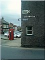
Daily life in DL8 1AG is supported by a range of nearby amenities. The retail sector includes Co-op Bedale, Morrisons Daily, and Tesco Bedale, providing essential shopping options within practical reach. For transport, the area is served by three metro stations: Bedale, Leeming Bar, and Finghall, offering connections to larger towns and cities. Leeming Airport is also nearby, adding to the area’s accessibility for travel. While the data does not specify parks or leisure facilities, the absence of planning constraints like AONB or protected woodlands suggests open spaces may be available for recreation. The combination of local shops, transport links, and proximity to an airport makes DL8 1AG convenient for both everyday needs and occasional travel, supporting a lifestyle that balances suburban tranquillity with urban connectivity.
Amenities
Schools
The nearest school to DL8 1AG is Bedale High School, a primary school with an Ofsted rating of satisfactory. This single school serves the local community, offering education for younger children. The absence of secondary schools in the immediate area means families may need to travel to nearby towns for secondary education. However, the satisfactory rating suggests the school meets basic standards, though it may not excel in specialist subjects or extracurriculars. For parents, this means a reliance on local primary education with a need to plan for secondary schooling elsewhere. The school’s presence adds to the area’s appeal for families, though the lack of a full range of educational institutions could be a consideration for those prioritising comprehensive local schooling.
| Rank | School | Type | Entry gender | Ages |
|---|
Explore more schools in this area
Go to Schools tabDemographics
The community in DL8 1AG is predominantly composed of adults aged 30–64, reflecting a mature demographic with a median age of 47. Home ownership is high at 68%, indicating a strong presence of long-term residents. The area is largely White, with no specific data on other ethnic groups provided. This age profile suggests a mix of established families, professionals, and retirees, all contributing to a stable local economy. The absence of detailed diversity statistics means the community’s social fabric is largely defined by this dominant group. The low population density of 271 people per square kilometre ensures a quieter, less congested environment compared to urban areas. For buyers, this demographic profile implies a neighbourhood with consistent demand for housing, though it may lack the cultural diversity found in larger towns.
Household Size
Accommodation Type
Tenure
Ethnic Group
Religion
Household Composition
Age
Household Deprivation
NS-SEC
Explore more demographic insights in this area
Go to Demographics tabPlanning
Planning Constraints
- Flood RiskPremium
- Ramsar Wetland SitesPremium
- Area of Outstanding Natural BeautyPremium
- Protected Nature ReservePremium
- Protected WoodlandPremium