Area Overview for DL7 9SN
Photos of DL7 9SN


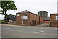
21 photos from this area
Area Information
Key information about the DL7 9SN including its size, population, and administrative classification.
- Area Type
- Postcode
- Area Size
- 5.5 hectares
- Population
- 2699
- Population Density
- 79 people/km²
House Prices in DL7 9SN
12
Properties
£174,079
Average Sold Price
£83,550
Lowest Price
£265,000
Highest Price
Showing 12 properties
| Address | Type | Beds | Baths | Last Sale Price | Last Sale Date | |
|---|---|---|---|---|---|---|
| 47 Roman Road, Leeming, DL7 9SN | Bungalow | 3 | 2 | £140,000 | Jun 2023 | |
| Leeming Methodist Church, Roman Road, Leeming, DL7 9SN | house | - | - | £83,550 | Feb 2021 | |
| Glen Moire, 53 Roman Road, Leeming, DL7 9SN | Bungalow | 3 | - | £200,000 | Jul 2020 | |
| Villa Mea, 49 Roman Road, Leeming, DL7 9SN | house | - | - | £235,000 | Nov 2019 | |
| 45 Roman Road, Leeming, DL7 9SN | Semi-detached | 2 | 1 | £135,000 | Dec 2018 | |
| Nasus, 43 Roman Road, Leeming, DL7 9SN | Bungalow | - | - | £160,000 | Mar 2017 | |
| Orchard Croft, 55 Roman Road, Leeming, DL7 9SN | Bungalow | - | - | £265,000 | Mar 2016 | |
| 35 Roman Road, Leeming, DL7 9SN | house | - | - | - | - | |
| 59 Roman Road, Leeming, DL7 9SN | Detached | - | - | - | - | |
| Managers Accommodation, The Willow Tree Inn, 51 Roman Road, Leeming, DL7 9SN | Flat | - | - | - | - |
Page 1 of 2
Energy Efficiency in DL7 9SN
Amenities
Schools
| Rank | School | Type | Entry gender | Ages |
|---|
Explore more schools in this area
Go to Schools tabDemographics
Household Size
Two person
most common
Accommodation Type
Houses
most common
Tenure
55
majority
Ethnic Group
White
most common
Religion
N/A
most common
Household Composition
N/A
most common
Age
47
median
Adults (30-64 years)
most common
Household Deprivation
N/A
with no deprivation
NS-SEC
41
in Lower managerial occupations
Explore more demographic insights in this area
Go to Demographics tabPlanning
Planning Constraints
- Flood RiskPremium
- Ramsar Wetland SitesPremium
- Area of Outstanding Natural BeautyPremium
- Protected Nature ReservePremium
- Protected WoodlandPremium