Area Overview for DL7 9LN
Photos of DL7 9LN
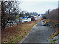
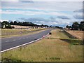
![New run off pond close to A1[M] in DL7 9LN](https://images.propbar.co.uk/images/geograph/50/84/5084904_120.jpg)


22 photos from this area
Area Information
Key information about the DL7 9LN including its size, population, and administrative classification.
- Area Type
- Postcode
- Area Size
- 18.5 hectares
- Population
- 1714
- Population Density
- 28 people/km²
House Prices in DL7 9LN
2
Properties
£1,250,000
Average Sold Price
£1,250,000
Lowest Price
£1,250,000
Highest Price
Showing 2 properties
| Address | Type | Beds | Baths | Last Sale Price | Last Sale Date | |
|---|---|---|---|---|---|---|
| Dere Street House, Bowbridge Lane, Little Holtby, DL7 9LN | house | - | - | £1,250,000 | May 2025 | |
| Street House Farm, Crabtree Hall Business Centre, Little Holtby, DL7 9LN | Detached | - | - | - | - |
Energy Efficiency in DL7 9LN
Amenities
Schools
| Rank | School | Type | Entry gender | Ages |
|---|
Explore more schools in this area
Go to Schools tabDemographics
Household Size
Two person
most common
Accommodation Type
Houses
most common
Tenure
70
majority
Ethnic Group
White
most common
Religion
N/A
most common
Household Composition
N/A
most common
Age
47
median
Adults (30-64 years)
most common
Household Deprivation
N/A
with no deprivation
NS-SEC
38
in Lower managerial occupations
Explore more demographic insights in this area
Go to Demographics tabPlanning
Planning Constraints
- Flood RiskPremium
- Ramsar Wetland SitesPremium
- Area of Outstanding Natural BeautyPremium
- Protected Nature ReservePremium
- Protected WoodlandPremium