Area Overview for DL7 0YL
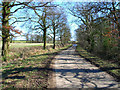
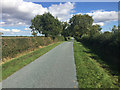
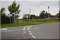
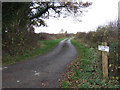
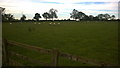
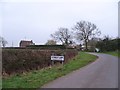
Photos of DL7 0YL
Area Information
DL7 0YL is a small, tightly knit residential area in England, home to 1865 residents spread across a low-density landscape of 28 people per square kilometre. This postcode covers a cluster of homes, predominantly houses, reflecting a community that values stability and family-oriented living. The area’s compact size means residents are close to essential amenities, including retail hubs like Co-op Catterick and Asda Northallerton, as well as transport links such as Northallerton Railway Station. The median age of 47 suggests a mature demographic, with many residents in their 30s to 60s, creating a sense of continuity and familiarity. Daily life here is shaped by proximity to schools, local shops, and quiet surroundings, making it ideal for those seeking a balanced lifestyle without the pressures of larger urban centres. The low population density also means a slower pace of life, with fewer crowds and more space for personal comfort. For buyers, DL7 0YL offers a blend of practicality and tranquillity, appealing to those prioritising safety, convenience, and a strong sense of community.
- Area Type
- Postcode
- Area Size
- Not available
- Population
- 1865
- Population Density
- 28 people/km²
The property market in DL7 0YL is characterised by high home ownership, with 80% of residents living in their own homes. This suggests a stable, long-term market where property is often held by families rather than speculative investors. The accommodation type is predominantly houses, which is typical of smaller, rural or semi-rural areas where larger homes are more common. This contrasts with urban centres where flats and apartments dominate. The limited size of the area means the housing stock is finite, so buyers should consider the proximity to nearby towns like Northallerton for additional options. The high home ownership rate also indicates that the area is not a rental hotspot, which may appeal to those seeking a place to settle rather than a short-term investment. For buyers, the mix of houses and the low population density offers a chance to find properties with space and privacy, though competition may be higher for the most desirable homes.
House Prices in DL7 0YL
No properties found in this postcode.
Energy Efficiency in DL7 0YL
Living in DL7 0YL offers access to a range of amenities within practical reach. Local retail options include Co-op Catterick, Asda Northallerton, and Sainsburys Northallerton, providing essential shopping and grocery needs. These stores cater to daily requirements, reducing the need for long trips to larger towns. The area’s transport links, such as Northallerton Railway Station and Leeming Bar Metro, connect residents to broader networks for leisure, work, or travel. While the area itself is small, its proximity to Northallerton and surrounding towns means residents can access more extensive facilities without inconvenience. The presence of schools and low population density contributes to a relaxed lifestyle, with fewer crowds and more space for personal activities. For those who enjoy outdoor pursuits, the surrounding landscape offers quiet areas to explore, though specific parks or recreational sites are not detailed in the data. Overall, DL7 0YL balances local convenience with easy access to larger amenities.
Amenities
Schools
DL7 0YL is served by Ainderby Steeple Church of England Primary School, which provides primary education for local children. This school has an Ofsted rating of satisfactory, indicating it meets basic standards but may not excel in all areas. Nearby, The Dales School offers special education services, catering to students with specific learning needs. The combination of a primary school and a special school suggests the area supports families with children requiring both mainstream and specialist education. While the primary school’s rating is not outstanding, the presence of two schools within practical reach reduces the need for long commutes. For families, this mix of educational options provides flexibility, though parents may need to supplement with additional resources if higher education or specialist support is required. The proximity of these schools is a key factor for buyers prioritising family-friendly living.
| Rank | School | Type | Entry gender | Ages |
|---|---|---|---|---|
| 1 | Ainderby Steeple Church of England Primary School | primary | N/A | N/A |
| 2 | The Dales School | special | N/A | N/A |
| 3 | Ainderby Steeple Church of England Primary School | primary | N/A | N/A |
Explore more schools in this area
Go to Schools tabDemographics
The community in DL7 0YL is predominantly composed of adults aged 30–64, with a median age of 47. This suggests a population that is largely in their prime working years, with many likely to be raising families or nearing retirement. Home ownership is high, at 80%, indicating a stable housing market and long-term residency for many residents. The area’s accommodation is primarily houses, which aligns with the demographic profile of older, established households. The predominant ethnic group is White, though no further breakdown of diversity is provided. The low population density of 28 people per square kilometre means the area is not densely populated, contributing to a quieter, more private living environment. This demographic profile supports a community focused on stability, with fewer transient residents and a strong emphasis on long-term investment in property. The absence of significant deprivation data implies a generally secure quality of life, with access to essential services and amenities.
Household Size
Accommodation Type
Tenure
Ethnic Group
Religion
Household Composition
Age
Household Deprivation
NS-SEC
Explore more demographic insights in this area
Go to Demographics tabPlanning
Planning Constraints
- Flood RiskPremium
- Ramsar Wetland SitesPremium
- Area of Outstanding Natural BeautyPremium
- Protected Nature ReservePremium
- Protected WoodlandPremium
- Crime RiskPremium