Area Overview for DL6 3YX
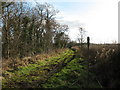
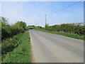
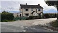
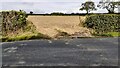
Photos of DL6 3YX


Area Information
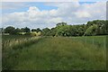
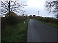
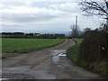
DL6 3YX is a small, tightly knit residential postcode area in England, home to 1804 residents spread across a low-density landscape of 31 people per square kilometre. This quiet cluster of homes reflects a community rooted in stability, with a median age of 47 and a strong presence of adults aged 30–64. The area’s character is defined by its predominantly owner-occupied housing stock, with 78% of properties owned by residents rather than rented. Daily life here is shaped by proximity to essential services, including nearby schools, retail outlets, and transport links. While the population is small, the area offers a balance of practicality and tranquillity, with no major environmental constraints or safety risks. Residents benefit from low crime rates, a safety score of 97, and minimal flood risk, making it an attractive option for those seeking a secure, low-maintenance lifestyle. The mix of primary and special schools, combined with accessible amenities, ensures families can meet both everyday and long-term needs without venturing far.
- Area Type
- Postcode
- Area Size
- Not available
- Population
- 1804
- Population Density
- 31 people/km²
The property market in DL6 3YX is defined by high home ownership (78%) and a focus on houses rather than flats or apartments. This suggests a market dominated by owner-occupied properties, likely catering to families and long-term residents. The small size of the area means the housing stock is limited, with fewer opportunities for new developments or rental properties. Buyers should consider that the primary accommodation type—houses—may offer more space and privacy, though this also means the market is less dynamic in terms of turnover. The low population density and absence of planning constraints (such as protected areas or wetlands) suggest that property values are not heavily influenced by environmental factors. For those seeking a stable, low-risk investment, DL6 3YX’s owner-occupied profile and safety record make it a viable option, though the limited number of properties may require a targeted search in nearby areas.
House Prices in DL6 3YX
No properties found in this postcode.
Energy Efficiency in DL6 3YX
The lifestyle in DL6 3YX is shaped by its proximity to essential amenities and a mix of practical retail options. Residents can access major supermarkets like Lidl Northallerton, Iceland Northallerton, and Tesco Northallerton, ensuring daily shopping needs are met without long journeys. The area’s rail link to Northallerton Railway Station provides access to broader transport networks, while Leeming Airport offers regional travel options. Though the data does not list parks or leisure facilities, the low population density and absence of environmental constraints suggest space for outdoor activities. The presence of multiple schools and the community’s established character contribute to a stable, family-friendly environment. While the retail and transport options are sufficient for daily life, the area’s charm lies in its quiet, low-maintenance appeal, ideal for those prioritising safety and simplicity over urban conveniences.
Amenities
Schools
Residents of DL6 3YX have access to a range of schools, including primary and special education options. Nearby primary schools include South Otterington Church of England Primary School, which holds a ‘good’ Ofsted rating, and Thornton-Le-Moor CofE Primary School. Newby Wiske County Primary School and South Otterington Church of England Voluntary Controlled Primary School also serve the area. For special educational needs, Breckenbrough School provides tailored support. The mix of school types ensures families can choose between mainstream primary education and specialist provisions. The presence of multiple primary schools reduces travel distances for younger children, while the inclusion of a special school highlights the area’s commitment to inclusive education. These options collectively support a well-rounded educational environment, though parents may need to consider commuting for secondary schooling, as no secondary schools are listed in the data.
| Rank | School | Type | Entry gender | Ages |
|---|
Explore more schools in this area
Go to Schools tabDemographics
The demographic profile of DL6 3YX is marked by a median age of 47, with the majority of residents falling within the 30–64 age bracket. This suggests a mature, established community with a focus on stability. Home ownership is high, with 78% of properties owned by their occupants, indicating a preference for long-term residency over rental living. The accommodation type is predominantly houses, which aligns with the area’s low population density and character as a residential cluster. The predominant ethnic group is White, reflecting a homogenous community profile. The age distribution and high home ownership rate suggest a population that is largely settled, with fewer young families or transient residents. The absence of specific data on deprivation means the area’s quality of life is inferred from its low crime rates and environmental safety, which support a comfortable, secure living environment.
Household Size
Accommodation Type
Tenure
Ethnic Group
Religion
Household Composition
Age
Household Deprivation
NS-SEC
Explore more demographic insights in this area
Go to Demographics tabPlanning
Planning Constraints
- Flood RiskPremium
- Ramsar Wetland SitesPremium
- Area of Outstanding Natural BeautyPremium
- Protected Nature ReservePremium
- Protected WoodlandPremium