Area Overview for DL6 2FF
Photos of DL6 2FF
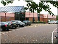
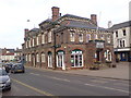
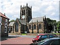
![Darlington Road [A167] in DL6 2FF](https://images.propbar.co.uk/images/geograph/15/05/1505659_120.jpg)
100 photos from this area
Area Information
Key information about the DL6 2FF including its size, population, and administrative classification.
- Area Type
- Postcode
- Area Size
- Not available
- Population
- 1523
- Population Density
- 188 people/km²
House Prices in DL6 2FF
2
Properties
-
Average Sold Price
-
Lowest Price
-
Highest Price
Showing 2 properties
| Address | Type | Beds | Baths | Last Sale Price | Last Sale Date | |
|---|---|---|---|---|---|---|
| Caretakers House, Civic Centre Stone Cross, Rotary Way, Northallerton, DL6 2FF | Detached | - | - | - | - | |
| The Caretakers House, Northallerton Road, Brompton, DL6 2FF | Detached | - | - | - | - |
Energy Efficiency in DL6 2FF
Amenities
Schools
| Rank | School | Type | Entry gender | Ages |
|---|
Explore more schools in this area
Go to Schools tabDemographics
Household Size
Two person
most common
Accommodation Type
Houses
most common
Tenure
84
majority
Ethnic Group
White
most common
Religion
N/A
most common
Household Composition
N/A
most common
Age
47
median
Adults (30-64 years)
most common
Household Deprivation
N/A
with no deprivation
NS-SEC
40
in Lower managerial occupations
Explore more demographic insights in this area
Go to Demographics tabPlanning
Planning Constraints
- Flood RiskPremium
- Ramsar Wetland SitesPremium
- Area of Outstanding Natural BeautyPremium
- Protected Nature ReservePremium
- Protected WoodlandPremium