Area Overview for DL6 1NG
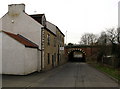
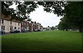
Photos of DL6 1NG


Area Information
DL6 1NG is a small, tightly knit residential postcode in England, home to just 1,699 people. This area is characterised by its compact size and the presence of family-oriented housing, with a median age of 47 and the majority of residents falling within the 30-64 age range. The community here is likely to be stable, with a focus on established households. Proximity to Northallerton Railway Station and Leeming Airport ensures connectivity to broader regional networks, while nearby retail hubs like M&S Northallerton and Asda Northallerton provide daily conveniences. The area’s small scale means it is not densely populated, offering a quieter alternative to larger towns. However, its limited size also means that residents may need to look further afield for more extensive amenities. The presence of Applegarth Primary School, rated ‘good’ by Ofsted, adds to the appeal for families, though the area lacks specialist educational facilities beyond primary level.
- Area Type
- Postcode
- Area Size
- Not available
- Population
- 1699
- Population Density
- 3877 people/km²
DL6 1NG is a small area with a housing stock dominated by individual houses, as opposed to flats or apartments. The home ownership rate of 44% implies that just over a third of properties are owner-occupied, with the rest likely to be rented out. This mix may appeal to both buyers seeking long-term investment and renters looking for stable housing. Given the area’s limited size, the property market here is unlikely to be highly competitive, and buyers may need to consider nearby postcode areas for more options. The predominance of houses suggests a focus on family homes, which could be a draw for those prioritising space and privacy. However, the low home ownership rate also indicates that rental demand may be significant, potentially affecting property values and availability for purchase.
House Prices in DL6 1NG
No properties found in this postcode.
Energy Efficiency in DL6 1NG
DL6 1NG offers a range of amenities within practical reach, including retail options such as M&S Northallerton, Asda Northallerton, and Iceland Northallerton. These shops provide access to everyday goods, from groceries to clothing, reducing the need for long journeys. The Northallerton Railway Station and Leeming Airport cater to travel needs, while Leeming Bar metro stop offers local transport links. Though the area is small, the combination of retail, transport, and nearby services creates a functional lifestyle for residents. The presence of a primary school and specialist educational services also supports family life. However, the limited size of DL6 1NG means that residents may need to venture further for more diverse leisure or entertainment options, which are likely concentrated in nearby towns.
Amenities
Schools
The nearest schools to DL6 1NG include Applegarth Primary School, which is rated ‘good’ by Ofsted, and Hambleton/Richmondshire Pupil Referral Service, which caters to students with specific educational needs. Applegarth Primary School’s ‘good’ rating is a strong point for families, offering a reliable foundation for early education. However, the absence of secondary schools or other educational institutions within the area means that students may need to travel to nearby towns for further schooling. The presence of a pupil referral service indicates that the area accommodates a range of educational requirements, including support for students with complex needs. For families prioritising a comprehensive school network, DL6 1NG may require additional planning for secondary education.
| Rank | School | Type | Entry gender | Ages |
|---|
Explore more schools in this area
Go to Schools tabDemographics
The population of DL6 1NG is predominantly adults aged 30-64, with a median age of 47. This suggests a community of middle-aged residents, many of whom may be in their peak earning years or raising children. Home ownership in the area stands at 44%, indicating that nearly half of properties are owner-occupied, while the remaining are likely rental properties. The accommodation type is primarily houses, which aligns with the area’s small, residential character. The predominant ethnic group is White, reflecting a homogenous demographic profile. With no data on deprivation or diversity beyond this, the area appears to cater to a specific segment of the population. The age profile and home ownership rate suggest a balance between stability and potential demand for rental properties, though the small population size limits the scope for broader demographic trends.
Household Size
Accommodation Type
Tenure
Ethnic Group
Religion
Household Composition
Age
Household Deprivation
NS-SEC
Explore more demographic insights in this area
Go to Demographics tabPlanning
Planning Constraints
- Flood RiskPremium
- Ramsar Wetland SitesPremium
- Area of Outstanding Natural BeautyPremium
- Protected Nature ReservePremium
- Protected WoodlandPremium