Area Overview for DL11 7YR
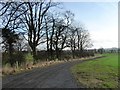
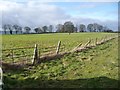
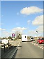
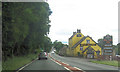
Photos of DL11 7YR


Area Information
Living in DL11 7YR offers a quiet, low-density lifestyle in a small residential cluster with a population of just 1,335. The area’s sparse population density of 23 people per square kilometre suggests spacious living, with homes likely set apart from one another. This postcode is ideal for those seeking a calm, community-focused environment, where daily life revolves around local amenities and a mature demographic. The median age of 47 indicates a predominantly adult population, with the majority aged between 30 and 64. This suggests a stable, family-oriented community, though with fewer younger residents. Safety is a key feature, with a crime risk score of 94, reflecting below-average crime rates. The area’s proximity to retail outlets like M&S Scotch and Asda Scotch adds to its convenience, while the lack of significant planning constraints means fewer restrictions on development. For buyers, DL11 7YR presents a rare opportunity to own property in a low-risk, low-traffic environment with a strong sense of local identity.
- Area Type
- Postcode
- Area Size
- Not available
- Population
- 1335
- Population Density
- 23 people/km²
DL11 7YR is primarily an owner-occupied area, with 71% of residents living in properties they own. The housing stock is dominated by houses rather than flats, reflecting the area’s low population density and likely spacious, standalone homes. This makes it an attractive option for buyers seeking private, long-term living without the pressures of a high-density rental market. The small size of the postcode means the immediate surroundings are likely to have a similar housing profile, with limited options for new developments. For buyers, this could mean fewer properties to choose from but a more established community with stable property values. The high home ownership rate also suggests a lower turnover of properties, which may contribute to a sense of continuity and local identity. However, the limited size of the area could restrict the availability of diverse property types, making it essential for buyers to consider nearby regions for alternative options.
House Prices in DL11 7YR
No properties found in this postcode.
Energy Efficiency in DL11 7YR
The lifestyle in DL11 7YR is shaped by its proximity to retail amenities, including M&S Scotch, Asda Scotch, and Morrisons Daily. These stores provide convenient access to groceries, clothing, and household essentials, supporting a self-contained daily life. The area’s small size and low population density likely foster a village-like atmosphere, where local shops serve as community hubs. However, the absence of parks, leisure facilities, or entertainment venues in the data means that residents may need to travel to nearby towns for recreational activities. The presence of five retail outlets within practical reach indicates a focus on practical convenience, though it may lack the cultural or social amenities found in larger settlements. For those prioritising ease of shopping and a quiet environment, DL11 7YR offers a functional, low-stress lifestyle.
Amenities
Schools
The nearest school to DL11 7YR is Eppleby Forcett Church of England Primary School, which serves the area’s primary education needs. The school is listed with a ‘good’ Ofsted rating, indicating a satisfactory standard of teaching and facilities. As the only school mentioned in the data, it is the primary option for families in the area. The absence of secondary schools or other educational institutions within the postcode suggests that students may need to travel to nearby towns for higher education. The presence of a single primary school with a good rating is a positive factor for families, though the lack of additional schools may limit choices for those requiring specialist provision or alternative schooling. The school’s religious affiliation as a Church of England institution may also be a consideration for some families.
| Rank | School | Type | Entry gender | Ages |
|---|
Explore more schools in this area
Go to Schools tabDemographics
DL11 7YR’s population of 1,335 is predominantly composed of adults aged 30 to 64, with a median age of 47. This suggests a mature, established community with fewer young families or retirees. Home ownership is high at 71%, indicating a stable housing market where most residents live in their own homes rather than renting. The area is characterised by houses, not flats, which aligns with the low population density and likely larger property sizes. The predominant ethnic group is White, though no data on diversity or deprivation is provided. The age profile implies a community focused on long-term living, with fewer transient residents. This demographic mix may influence local services and amenities, which are tailored to adult needs rather than those of children or elderly populations. The low population density also means a lower demand for public transport, with car ownership likely being the primary mode of mobility.
Household Size
Accommodation Type
Tenure
Ethnic Group
Religion
Household Composition
Age
Household Deprivation
NS-SEC
Explore more demographic insights in this area
Go to Demographics tabPlanning
Planning Constraints
- Flood RiskPremium
- Ramsar Wetland SitesPremium
- Area of Outstanding Natural BeautyPremium
- Protected Nature ReservePremium
- Protected WoodlandPremium