Area Overview for DL11 6QT
Photos of DL11 6QT
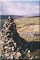
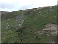
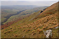
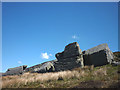


42 photos from this area
Area Information
Key information about the DL11 6QT including its size, population, and administrative classification.
- Area Type
- Postcode
- Area Size
- 90.6 hectares
- Population
- 1076
- Population Density
- 7 people/km²
House Prices in DL11 6QT
17
Properties
£244,464
Average Sold Price
£54,000
Lowest Price
£401,750
Highest Price
Showing 17 properties
| Address | Type | Beds | Baths | Last Sale Price | Last Sale Date | |
|---|---|---|---|---|---|---|
| Little Ashlands, Arkengarthdale Road, Reeth, DL11 6QT | house | - | - | £315,000 | Jun 2022 | |
| Ashlands, Arkengarthdale Road, Reeth, DL11 6QT | house | - | - | £310,500 | Mar 2021 | |
| Hill House Cottage, Arkengarthdale Road, Reeth, DL11 6QT | Cottage | 3 | 1 | £237,000 | Feb 2021 | |
| Heggs Farm, Arkengarthdale Road, Reeth, DL11 6QT | Detached | - | - | £401,750 | Feb 2019 | |
| Glenholme, Arkengarthdale Road, Reeth, DL11 6QT | house | - | - | £161,000 | Jan 2015 | |
| Arkle Holme, Arkengarthdale Road, Reeth, DL11 6QT | Bungalow | - | - | £232,000 | Jan 2014 | |
| Barn End, Arkengarthdale Road, Reeth, DL11 6QT | Semi-detached | - | - | £54,000 | Jun 1999 | |
| The Cottage, Arkengarthdale Road, Reeth, DL11 6QT | Semi-detached | - | - | - | - | |
| Greencroft, Arkengarthdale Road, Reeth, DL11 6QT | house | - | - | - | - | |
| Newholme, Arkengarthdale Road, Reeth, DL11 6QT | Semi-detached | - | - | - | - |
Page 1 of 2
Energy Efficiency in DL11 6QT
Amenities
Schools
| Rank | School | Type | Entry gender | Ages |
|---|
Explore more schools in this area
Go to Schools tabDemographics
Household Size
Two person
most common
Accommodation Type
Houses
most common
Tenure
68
majority
Ethnic Group
White
most common
Religion
N/A
most common
Household Composition
N/A
most common
Age
47
median
Adults (30-64 years)
most common
Household Deprivation
N/A
with no deprivation
NS-SEC
33
in Lower managerial occupations
Explore more demographic insights in this area
Go to Demographics tabPlanning
Planning Constraints
- Flood RiskPremium
- Ramsar Wetland SitesPremium
- Area of Outstanding Natural BeautyPremium
- Protected Nature ReservePremium
- Protected WoodlandPremium