Area Overview for DL11 6QG
Photos of DL11 6QG
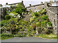
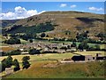
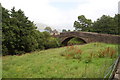
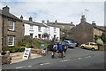
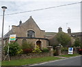
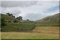
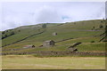
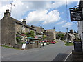
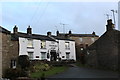
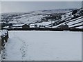
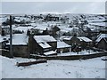
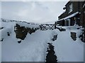
97 photos from this area
Area Information
Key information about the DL11 6QG including its size, population, and administrative classification.
- Area Type
- Postcode
- Area Size
- 98.5 hectares
- Population
- 1078
- Population Density
- 5 people/km²
House Prices in DL11 6QG
16
Properties
£337,600
Average Sold Price
£198,000
Lowest Price
£695,000
Highest Price
Showing 16 properties
| Address | Type | Beds | Baths | Last Sale Price | Last Sale Date | |
|---|---|---|---|---|---|---|
| Guildy Hall, Muker To Thwaite, Muker, DL11 6QG | Detached | 4 | 3 | £695,000 | Oct 2025 | |
| The Old Dairy, Guning Lane, Muker, DL11 6QG | Detached | 2 | 1 | £210,000 | May 2025 | |
| Rosedene, Muker To Thwaite, Muker, DL11 6QG | house | - | - | £198,000 | Nov 2015 | |
| Fern Cottage Rash, Guning Lane, Muker, DL11 6QG | Character Property | 3 | 1 | £250,000 | Jul 2014 | |
| Bridge End, Guning Lane, Muker, DL11 6QG | house | - | - | £335,000 | Jul 2007 | |
| The Flat, Old School, Muker To Thwaite, Muker, DL11 6QG | Flat | 2 | 1 | - | - | |
| Flat, Strawbeck, Muker To Thwaite, Muker, DL11 6QG | Flat | 4 | 1 | - | - | |
| The Arches, Guning Lane, Muker, DL11 6QG | Detached | 3 | 1 | - | - | |
| Chapel House, Guning Lane, Muker, DL11 6QG | Detached | 3 | 3 | - | - | |
| Farmers Arms, Muker Village Street, Muker, DL11 6QG | restaurant_cafe | - | - | - | - |
Page 1 of 2
Energy Efficiency in DL11 6QG
Amenities
Schools
| Rank | School | Type | Entry gender | Ages |
|---|
Explore more schools in this area
Go to Schools tabDemographics
Household Size
Two person
most common
Accommodation Type
Houses
most common
Tenure
75
majority
Ethnic Group
White
most common
Religion
N/A
most common
Household Composition
N/A
most common
Age
47
median
Adults (30-64 years)
most common
Household Deprivation
N/A
with no deprivation
NS-SEC
35
in Lower managerial occupations
Explore more demographic insights in this area
Go to Demographics tabPlanning
Planning Constraints
- Flood RiskPremium
- Ramsar Wetland SitesPremium
- Area of Outstanding Natural BeautyPremium
- Protected Nature ReservePremium
- Protected WoodlandPremium