Area Overview for DL11 6LE
Photos of DL11 6LE
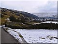
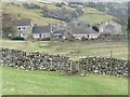
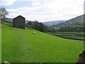


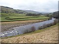
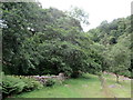
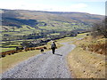
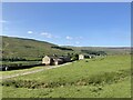
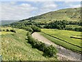
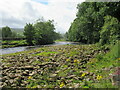
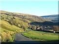
63 photos from this area
Area Information
Key information about the DL11 6LE including its size, population, and administrative classification.
- Area Type
- Postcode
- Area Size
- 67.5 hectares
- Population
- 1078
- Population Density
- 5 people/km²
House Prices in DL11 6LE
36
Properties
£276,136
Average Sold Price
£120,000
Lowest Price
£540,000
Highest Price
Showing 36 properties
| Address | Type | Beds | Baths | Last Sale Price | Last Sale Date | |
|---|---|---|---|---|---|---|
| Greenacres, Road From Ivelet To Gunnerside, Gunnerside, DL11 6LE | house | - | - | £450,000 | Mar 2025 | |
| Tetheran Cottage, Road To Gunnerside Methodist Primary School, Gunnerside, DL11 6LE | house | 3 | - | £300,000 | Jul 2023 | |
| Burnside, Road To Gunnerside Mill, Gunnerside, DL11 6LE | house | 1 | - | £270,000 | Mar 2023 | |
| Farmendon, Road To Gunnerside Methodist Primary School, Gunnerside, DL11 6LE | house | 3 | 1 | £365,000 | Nov 2022 | |
| Brow Hill, Road From Ivelet To Gunnerside, Gunnerside, DL11 6LE | Detached | 4 | - | £540,000 | Sep 2021 | |
| East Ing, Road From Ivelet To Gunnerside, Gunnerside, DL11 6LE | house | - | - | £348,000 | Jun 2021 | |
| Greystones, Road From Ivelet To Gunnerside, Gunnerside, DL11 6LE | house | 3 | 2 | £220,000 | Dec 2020 | |
| West Ing, Road From Ivelet To Gunnerside, Gunnerside, DL11 6LE | Semi-detached | - | - | £265,000 | Jul 2019 | |
| Moor Croft, Road From Ivelet To Gunnerside, Gunnerside, DL11 6LE | house | - | - | £440,000 | Jun 2019 | |
| Whitelock House, Road From Ivelet To Gunnerside, Gunnerside, DL11 6LE | house | - | - | £276,000 | Oct 2018 |
Page 1 of 4
Energy Efficiency in DL11 6LE
Amenities
Schools
| Rank | School | Type | Entry gender | Ages |
|---|
Explore more schools in this area
Go to Schools tabDemographics
Household Size
Two person
most common
Accommodation Type
Houses
most common
Tenure
75
majority
Ethnic Group
White
most common
Religion
N/A
most common
Household Composition
N/A
most common
Age
47
median
Adults (30-64 years)
most common
Household Deprivation
N/A
with no deprivation
NS-SEC
35
in Lower managerial occupations
Explore more demographic insights in this area
Go to Demographics tabPlanning
Planning Constraints
- Flood RiskPremium
- Ramsar Wetland SitesPremium
- Area of Outstanding Natural BeautyPremium
- Protected Nature ReservePremium
- Protected WoodlandPremium