Area Overview for DL11 6AE
Photos of DL11 6AE
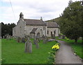
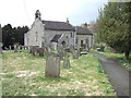
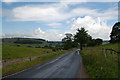
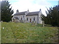
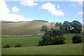
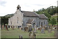
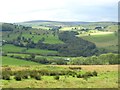

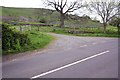
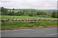
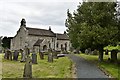
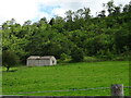
49 photos from this area
Area Information
Key information about the DL11 6AE including its size, population, and administrative classification.
- Area Type
- Postcode
- Area Size
- 7.3 km²
- Population
- 1078
- Population Density
- 5 people/km²
House Prices in DL11 6AE
21
Properties
£312,450
Average Sold Price
£80,000
Lowest Price
£840,000
Highest Price
Showing 21 properties
| Address | Type | Beds | Baths | Last Sale Price | Last Sale Date | |
|---|---|---|---|---|---|---|
| Kings Barn, Downholme Village North, Downholme, DL11 6AE | Semi-detached | 4 | 3 | £553,500 | Apr 2022 | |
| 15 Hudswell To Downholme Road, Downholme, Richmond, DL11 6AE | house | - | - | £276,000 | Feb 2022 | |
| The Old Vicarage, The Vicarage Road, Downholme, DL11 6AE | house | - | - | £840,000 | Oct 2021 | |
| Home Farm, Downholme Village North, Downholme, DL11 6AE | Farm | 3 | 2 | £335,000 | Jun 2021 | |
| 13 Hudswell To Downholme Road, Downholme, Richmond, DL11 6AE | house | 3 | 1 | £275,000 | Apr 2021 | |
| 14 Hudswell To Downholme Road, Downholme, Richmond, DL11 6AE | house | - | - | £190,000 | Jul 2019 | |
| 11 Downholme Village South, Downholme, DL11 6AE | Detached | 3 | 1 | £249,999 | Jan 2017 | |
| Kings Cottage, 12 Hudswell To Downholme Road, Downholme, Richmond, DL11 6AE | house | 3 | 2 | £130,000 | Aug 2013 | |
| 10 Downholme Village South, Downholme, DL11 6AE | Cottage | 2 | 1 | £80,000 | Aug 2013 | |
| 16 Hudswell To Downholme Road, Downholme, Richmond, DL11 6AE | house | - | - | £195,000 | Dec 2012 |
Page 1 of 3
Energy Efficiency in DL11 6AE
Amenities
Schools
| Rank | School | Type | Entry gender | Ages |
|---|
Explore more schools in this area
Go to Schools tabDemographics
Household Size
Two person
most common
Accommodation Type
Houses
most common
Tenure
75
majority
Ethnic Group
White
most common
Religion
N/A
most common
Household Composition
N/A
most common
Age
47
median
Adults (30-64 years)
most common
Household Deprivation
N/A
with no deprivation
NS-SEC
35
in Lower managerial occupations
Explore more demographic insights in this area
Go to Demographics tabPlanning
Planning Constraints
- Flood RiskPremium
- Ramsar Wetland SitesPremium
- Area of Outstanding Natural BeautyPremium
- Protected Nature ReservePremium
- Protected WoodlandPremium