Area Overview for DL10 7UB
Photos of DL10 7UB

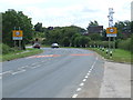
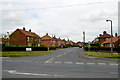
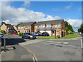

11 photos from this area
Area Information
Key information about the DL10 7UB including its size, population, and administrative classification.
- Area Type
- Postcode
- Area Size
- 5.4 hectares
- Population
- 1166
- Population Density
- 993 people/km²
House Prices in DL10 7UB
14
Properties
£161,979
Average Sold Price
£2,750
Lowest Price
£342,500
Highest Price
Showing 14 properties
| Address | Type | Beds | Baths | Last Sale Price | Last Sale Date | |
|---|---|---|---|---|---|---|
| 6 St Paulinus Crescent, Catterick Village, DL10 7UB | Semi-detached | 2 | 1 | £177,000 | Jul 2025 | |
| 19 St Paulinus Crescent, Catterick Village, DL10 7UB | Detached | 4 | 2 | £342,500 | Feb 2022 | |
| 5 St Paulinus Crescent, Catterick Village, DL10 7UB | Detached | - | - | £2,750 | Oct 2019 | |
| 15 St Paulinus Crescent, Catterick Village, DL10 7UB | Semi-detached | 3 | 1 | £175,000 | Sep 2018 | |
| 21 St Paulinus Crescent, Catterick Village, DL10 7UB | house | - | - | £315,000 | Jul 2018 | |
| 8 St Paulinus Crescent, Catterick Village, DL10 7UB | Semi-detached | 2 | 1 | £126,500 | Jan 2014 | |
| 3 St Paulinus Crescent, Catterick Village, DL10 7UB | Detached | 4 | 2 | £225,000 | Mar 2008 | |
| 17 St Paulinus Crescent, Catterick Village, DL10 7UB | Semi-detached | - | - | £160,000 | Mar 2007 | |
| 2 St Paulinus Crescent, Catterick Village, DL10 7UB | house | - | - | £157,500 | Aug 2006 | |
| 4 St Paulinus Crescent, Catterick Village, DL10 7UB | house | 3 | 1 | £143,000 | Mar 2006 |
Page 1 of 2
Energy Efficiency in DL10 7UB
Amenities
Schools
| Rank | School | Type | Entry gender | Ages |
|---|
Explore more schools in this area
Go to Schools tabDemographics
Household Size
Two person
most common
Accommodation Type
Houses
most common
Tenure
74
majority
Ethnic Group
White
most common
Religion
N/A
most common
Household Composition
N/A
most common
Age
47
median
Adults (30-64 years)
most common
Household Deprivation
N/A
with no deprivation
NS-SEC
29
in Lower managerial occupations
Explore more demographic insights in this area
Go to Demographics tabPlanning
Planning Constraints
- Flood RiskPremium
- Ramsar Wetland SitesPremium
- Area of Outstanding Natural BeautyPremium
- Protected Nature ReservePremium
- Protected WoodlandPremium