Area Overview for DL10 7EU
Photos of DL10 7EU
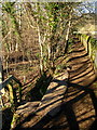

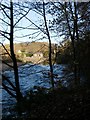
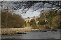
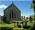
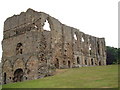
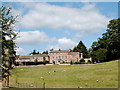
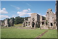
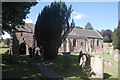
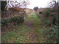
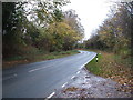
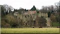
100 photos from this area
Area Information
Key information about the DL10 7EU including its size, population, and administrative classification.
- Area Type
- Postcode
- Area Size
- 1.2 km²
- Population
- 1650
- Population Density
- 48 people/km²
House Prices in DL10 7EU
25
Properties
£446,929
Average Sold Price
£27,500
Lowest Price
£883,000
Highest Price
Showing 25 properties
| Address | Type | Beds | Baths | Last Sale Price | Last Sale Date | |
|---|---|---|---|---|---|---|
| Home Lodge, 5 Easby Mews, Easby, DL10 7EU | Terraced | 2 | 1 | £360,000 | Jan 2025 | |
| The Mullions, Easby Access Road, Easby, DL10 7EU | Detached | 4 | 2 | £883,000 | Jan 2024 | |
| Custodians Cottage, Love Lane, Easby, DL10 7EU | Detached | - | - | £27,500 | Mar 2018 | |
| 6 Easby Mews, Easby, DL10 7EU | Cottage | 3 | 2 | £235,000 | Dec 2017 | |
| Abbey House, Love Lane, Easby, DL10 7EU | house | - | - | £455,000 | Dec 2015 | |
| Heron Cottage, 4 Easby Mews, Easby, DL10 7EU | house | 3 | 2 | £313,000 | Aug 2014 | |
| St Agathas House, Love Lane, Easby, DL10 7EU | house | 5 | - | £855,000 | Dec 2010 | |
| Easby Hall, Love Lane, Easby, DL10 7EU | house | 3 | 6 | - | - | |
| 3 Easby Mews, Easby, DL10 7EU | Semi-detached | 3 | 2 | - | - | |
| Abbey Fields, 2 Easby Mews, Easby, DL10 7EU | Terraced | - | - | - | - |
Page 1 of 3
Energy Efficiency in DL10 7EU
Amenities
Schools
| Rank | School | Type | Entry gender | Ages |
|---|
Explore more schools in this area
Go to Schools tabDemographics
Household Size
Two person
most common
Accommodation Type
Houses
most common
Tenure
72
majority
Ethnic Group
White
most common
Religion
N/A
most common
Household Composition
N/A
most common
Age
47
median
Adults (30-64 years)
most common
Household Deprivation
N/A
with no deprivation
NS-SEC
39
in Lower managerial occupations
Explore more demographic insights in this area
Go to Demographics tabPlanning
Planning Constraints
- Flood RiskPremium
- Ramsar Wetland SitesPremium
- Area of Outstanding Natural BeautyPremium
- Protected Nature ReservePremium
- Protected WoodlandPremium