Area Overview for DL10 7AE
Photos of DL10 7AE
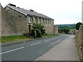
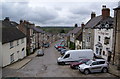
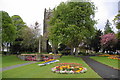
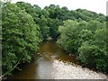
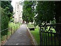
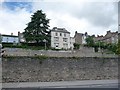
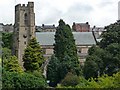
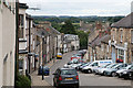
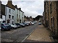
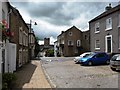
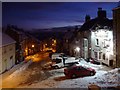
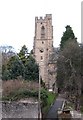
100 photos from this area
Area Information
Key information about the DL10 7AE including its size, population, and administrative classification.
- Area Type
- Postcode
- Area Size
- 7791 m²
- Population
- 1174
- Population Density
- 2540 people/km²
House Prices in DL10 7AE
22
Properties
£349,050
Average Sold Price
£185,000
Lowest Price
£500,000
Highest Price
Showing 22 properties
| Address | Type | Beds | Baths | Last Sale Price | Last Sale Date | |
|---|---|---|---|---|---|---|
| 71 Frenchgate, Richmond, DL10 7AE | Cottage | 2 | 1 | £334,950 | Sep 2024 | |
| 57 Frenchgate, Richmond, DL10 7AE | house | - | - | £325,000 | Apr 2023 | |
| 85 Frenchgate, Richmond, DL10 7AE | house | - | - | £500,000 | Mar 2018 | |
| Zetland House, 95 Frenchgate, Richmond, DL10 7AE | Character Property | 4 | 4 | £425,000 | Dec 2016 | |
| 89 Frenchgate, Richmond, DL10 7AE | house | 3 | 1 | £246,500 | Oct 2016 | |
| 91 Frenchgate, Richmond, DL10 7AE | Terraced | - | - | £185,000 | Jan 2013 | |
| 69 Frenchgate, Richmond, DL10 7AE | Character Property | 3 | 2 | £420,000 | Aug 2010 | |
| 87 Frenchgate, Richmond, DL10 7AE | house | - | - | £470,000 | Aug 2010 | |
| 47 Frenchgate, Richmond, DL10 7AE | Terraced | 2 | 1 | £235,000 | Jul 2002 | |
| 87A Frenchgate, Richmond, DL10 7AE | Flat | - | - | - | - |
Page 1 of 3
Energy Efficiency in DL10 7AE
Amenities
Schools
| Rank | School | Type | Entry gender | Ages |
|---|
Explore more schools in this area
Go to Schools tabDemographics
Household Size
One person
most common
Accommodation Type
Houses
most common
Tenure
56
majority
Ethnic Group
White
most common
Religion
N/A
most common
Household Composition
N/A
most common
Age
47
median
Adults (30-64 years)
most common
Household Deprivation
N/A
with no deprivation
NS-SEC
34
in Lower managerial occupations
Explore more demographic insights in this area
Go to Demographics tabPlanning
Planning Constraints
- Flood RiskPremium
- Ramsar Wetland SitesPremium
- Area of Outstanding Natural BeautyPremium
- Protected Nature ReservePremium
- Protected WoodlandPremium