Area Overview for DL10 5LZ
Photos of DL10 5LZ
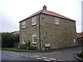
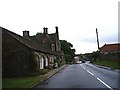

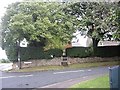
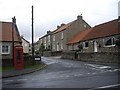
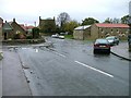
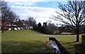
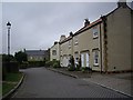
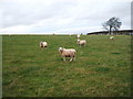
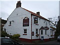
46 photos from this area
Area Information
Key information about the DL10 5LZ including its size, population, and administrative classification.
- Area Type
- Postcode
- Area Size
- 2.4 hectares
- Population
- 1407
- Population Density
- 43 people/km²
House Prices in DL10 5LZ
28
Properties
£210,526
Average Sold Price
£56,500
Lowest Price
£735,000
Highest Price
Showing 28 properties
| Address | Type | Beds | Baths | Last Sale Price | Last Sale Date | |
|---|---|---|---|---|---|---|
| 32 High Row, Melsonby, DL10 5LZ | Cottage | 3 | 2 | £395,000 | Sep 2023 | |
| Middleton House, 30 High Row, Melsonby, DL10 5LZ | house | - | - | £735,000 | Mar 2023 | |
| 22 High Row, Melsonby, DL10 5LZ | house | - | - | £175,500 | Jul 2022 | |
| 26 High Row, Melsonby, DL10 5LZ | house | - | - | £137,000 | Jul 2021 | |
| 16 High Row, Melsonby, DL10 5LZ | Terraced | 3 | 1 | £164,950 | Jan 2021 | |
| 46 High Row, Melsonby, DL10 5LZ | house | 3 | - | £260,000 | Oct 2020 | |
| 20 High Row, Melsonby, DL10 5LZ | Terraced | 3 | 1 | £252,500 | Jul 2018 | |
| 28 High Row, Melsonby, DL10 5LZ | Terraced | 2 | 1 | £80,000 | May 2018 | |
| 44 High Row, Melsonby, DL10 5LZ | Terraced | 4 | 1 | £210,000 | Dec 2016 | |
| 48 High Row, Melsonby, DL10 5LZ | house | 2 | 1 | £118,500 | Apr 2016 |
Page 1 of 3
Energy Efficiency in DL10 5LZ
Amenities
Schools
| Rank | School | Type | Entry gender | Ages |
|---|
Explore more schools in this area
Go to Schools tabDemographics
Household Size
Two person
most common
Accommodation Type
Houses
most common
Tenure
73
majority
Ethnic Group
White
most common
Religion
N/A
most common
Household Composition
N/A
most common
Age
47
median
Adults (30-64 years)
most common
Household Deprivation
N/A
with no deprivation
NS-SEC
44
in Lower managerial occupations
Explore more demographic insights in this area
Go to Demographics tabPlanning
Planning Constraints
- Flood RiskPremium
- Ramsar Wetland SitesPremium
- Area of Outstanding Natural BeautyPremium
- Protected Nature ReservePremium
- Protected WoodlandPremium