Area Overview for Denton
Photos of Denton

Area Information
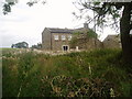
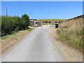
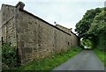
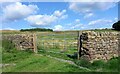
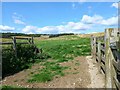
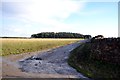
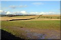
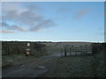
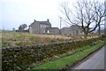
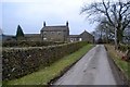
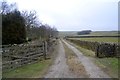
Living in Denton offers a distinctly rural experience within the Harrogate district of North Yorkshire, though it is situated north-east of Ilkley in West Yorkshire. This civil parish covers an area size of 13.1 square kilometres, establishing a defined yet spacious boundary for its residents. History defines the character of this settlement, which began as a chapelry in the parish of Otley. Parish registers trace back to 1766, and the area formally became a civil parish under the Poor Law Amendment Act in 1866. Denton Hall stands as a notable physical landmark in the hamlet, representing the historic presence of the Fairfax family and the Palladian style architecture designed by John Carr of York. The current population is sparse, with fewer than 100 residents recorded during the 2011 Census. This small population size creates a quiet environment where daily life moves at a slower pace compared to larger towns. You can find homes here in a setting that feels removed from the intensity of city living, prioritising open space and historic preservation over dense development. The location coordinates approximately 53.9499° N, 1.7830° W place Denton in a specific corner of England that balances agricultural heritage with local tourist attractions. For those considering a move to this civil parish, the settlement provides a backdrop of quiet tradition rather than modern urban noise. This context helps you understand the lifestyle potential within this specific parish boundary.
- Area Type
- Parish
- Area Size
- 13.1 km²
- Population
- Not available
- Population Density
- Not available
Demographics
The community profile of Denton reflects its status as a quiet, established rural settlement rather than a high-density commuter hub. The median age for residents is 70 years old, and the most common age range is recorded as Total for age grouping purposes. This demographic skew suggests that many current homeowners have lived in their properties for several decades. Home ownership stands at a high level, with 77% of households owning their homes outright or with a mortgage. This figure indicates a stable community where property is often passed down or built for long-term residence rather than short-term renting. You will encounter a homogenous social fabric that has developed over centuries of local history. Ethnically, the predominant group forms the majority of the population, consistent with older English rural parishes. Religious affiliations, though not numerically broken down in the latest specific breakdown, remain part of the community identity. Household composition follows the total structure typical of the region, supporting the higher ownership rate. Because the median age is significantly higher, you might expect to find fewer young families compared to other districts. The lack of data on specific deprivation indices means you should focus on the clear indicator of wealth and stability: the high rate of home ownership. This statistic, at 77%, tells you directly about the financial commitment residents have made to living in this specific civil parish.
Household Size
Accommodation Type
Tenure
Ethnic Group
Religion
Household Composition
Age
Household Deprivation
NS-SEC
Explore more demographic insights in this area
Go to Demographics tabPlanning
Planning Constraints
- Flood RiskPremium
- Ramsar Wetland SitesPremium
- Area of Outstanding Natural BeautyPremium
- Protected Nature ReservePremium
- Protected WoodlandPremium
- Crime RiskPremium