Area Overview for Cross Roads
Photos of Cross Roads
Area Information
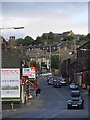
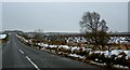
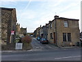
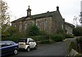
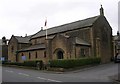
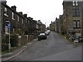
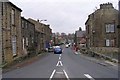
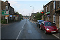
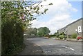
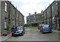
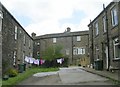
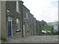
Cross Roads is a distinct civil parish within the City of Bradford Metropolitan District in West Yorkshire. This small settlement spans just 2.5 km², making it a compact community among West Yorkshire's larger regions. The area functions as a collection rather than a single village, comprising several small hamlets including Lees, Barcroft, Bocking, Bingley Road, and Cross Roads itself. Its name derives from the specific junction where the settlement began, a crossroads point leading toward Haworth, Keighley, and Denholme. You will find Halifax Road running through the village as it forms part of the wider A629 road network. This geographical position places the community less than one mile from the historic town of Haworth and approximately 2.5 miles from Keighley. Larger centres such as Bradford lie about 9 km away. Over centuries, the area transitioned from early landholdings by Rievaulx Abbey and Nostell Priory to an industrial population combining farming with spinning by 1712. Ebor Mill began construction in 1790, followed by Vale Mill in 1798 and Lees Mill in 1844, establishing the parish as a significant wool-producing community. A Co-operative Society formed in 1861, marking its status as one of the earliest co-operatives in the country. Today, the Cross Roads Inn sits at the historic junction, serving as a focal point for the local population.
- Area Type
- Parish
- Area Size
- 2.5 km²
- Population
- Not available
- Population Density
- Not available
Demographics
The people of Cross Roads live in a mature community where age is a defining characteristic. The median age across the parish stands at 70, placing it significantly older than the national average. While detailed breakdowns for specific age group ranges are not further detailed beyond the total population count, this high median indicates a settlement dominated by older residents. This demographic profile suggests a quiet, settled neighbourhood rather than a dynamic hub for young families or students. Home ownership rates within the parish reach 78 per cent, a figure that reflects the stability of this long-established community. Such a high rate of owner occupation typically correlates with lower mobility and a deeply rooted local presence. The housing stock largely serves self-selected buyers who prefer living in a village environment with a strong sense of place. Accommodation types and household compositions follow this pattern of established residency. The absence of significant data regarding predominant ethnic groups or specific religious affiliations from this dataset means specific diversity metrics remain unrecorded in official summaries. However, the historical presence of multiple working family households in wool production industries from the 18th and 19th centuries implies a foundational social structure built around trade and local industry. The current demographic snapshot presents a picture of a traditional village where generations have remained in the same homes for decades.
Household Size
Accommodation Type
Tenure
Ethnic Group
Religion
Household Composition
Age
Household Deprivation
NS-SEC
Explore more demographic insights in this area
Go to Demographics tabPlanning
Planning Constraints
- Flood RiskLocked
- Ramsar Wetland SitesLocked
- Area of Outstanding Natural BeautyLocked
- Protected Nature ReserveLocked
- Protected WoodlandLocked
- Crime RiskLocked