Area Overview for Cherry Burton
Photos of Cherry Burton
Area Information
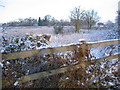
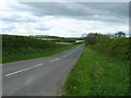
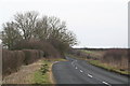
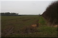
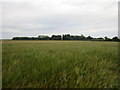
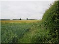
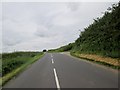
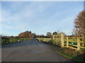
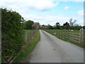
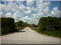
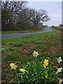
Living in Cherry Burton offers a distinct experience within a civil parish that spans 14.0 square kilometres of rural England. This area represents a significant departure from urban density, catering to those who prioritise space and tranquillity over city living. The sheer size of the parish provides a backdrop of open countryside, making it an ideal choice for residents who value access to nature and a slower pace of life. You will find a community deeply rooted in its environment, where daily life revolves around local amenities and the surrounding landscape rather than high-street shopping or crowded public transport hubs. The scale of the area suggests a close-knit neighbourhood structure where neighbours are likely to know one another. If you are considering homes in Cherry Burton, you are looking at a settlement defined by its pastoral character and relative isolation from major metropolitan centres. This setting suits individuals and families who have already secured their independence and are seeking stability rather than rapid urbanisation. Theabsence of significant planning constraints or protected natural reservations like AONBs means the land remains largely available for development, preserving the open feel of the parish while maintaining its rural identity.
- Area Type
- Parish
- Area Size
- 14.0 km²
- Population
- Not available
- Population Density
- Not available
Demographics
The community in Cherry Burton is defined by its exceptionally mature population, with a median age sitting precisely at seventy years. This demographic profile indicates that the area is primarily populated by retirees and older adults who have worked towards financial security throughout their careers. Ninety per cent of households in Cherry Burton own their homes, a figure that underscores the area's status as a retirement destination for those with capital to invest in property. This high level of ownership contrasts sharply with younger urban centres where rental dominance is common. The household composition reflects this reality, with most residents living in self-contained owner-occupied units rather than student flats or temporary accommodation chains. While specific data on predominant ethnicity and religious affiliation are not detailed in the current records, the social fabric is clearly shaped by a single, age-defined cohort. You should expect a quiet, stable environment where residents share a common life stage and likely similar interests in leisure and community engagement. This demographic concentration creates a predictable social dynamic, reducing the noise and uncertainty often found in mixed-age districts. For anyone evaluating Cherry Burton, the age data signals a retirement haven rather than a family-raising hub or a youth-oriented zone.
Household Size
Accommodation Type
Tenure
Ethnic Group
Religion
Household Composition
Age
Household Deprivation
NS-SEC
Explore more demographic insights in this area
Go to Demographics tabPlanning
Planning Constraints
- Flood RiskPremium
- Ramsar Wetland SitesPremium
- Area of Outstanding Natural BeautyPremium
- Protected Nature ReservePremium
- Protected WoodlandPremium
- Crime RiskPremium